Goal: The loss of ecological integrity management goal in the MSPA is to protect, maintain, enhance and restore natural communities and important ecosystem processes to maintain high levels of ecological integrity in the regional preserve system over the long-term (>100 years).
Management units: 1, 2, 3, 4, 5, 6, 7, 8, 9, 10, 11
In 2020, prepare a monitoring plan for riparian and oak woodland bird communities to assess community composition and diversity and the distribution and abundance of individual species across the MSPA in relation to impacts of tree mortality from invasive pests, drought and pathogens. The monitoring plan should build upon previous surveys and tree mortality sampling and include specific monitoring questions, the sampling frame within the MSPA, monitoring methods, a statistically valid sampling design, sampling locations, timeline, and standardized protocols.
| Action | Statement | Action status | Projects |
|---|---|---|---|
| PRP-1 | Submit project metadata and Riparian and Oak Woodland Bird Community Monitoring Plan to the MSP web portal. | On hold |
| Criteria | Deadline year |
|---|---|
| Riparian and Oak Woodland Bird Community Monitoring Plan completed in 2020 | 2021 |
| Threat Name | Threat Code |
|---|---|
| Loss of ecological integrity | ECOINT |
Management units: 1, 2, 3, 4, 5, 6, 7, 8, 9, 10, 11
In 2021, conduct surveys to implement the Riparian and Oak Woodland Bird Community Monitoring Plan.
| Action | Statement | Action status | Projects |
|---|---|---|---|
| IMP-1 | Submit project metadata, monitoring datasets and report to MSP web portal. | On hold |
| Criteria | Deadline year |
|---|---|
| Monitoring completed and report submitted in 2021 | 2021 |
| Threat Name | Threat Code |
|---|---|
| Loss of ecological integrity | ECOINT |
Management units: 1, 2, 3, 4, 5, 6, 7, 8, 9, 10, 11
In 2021, prepare a monitoring plan to survey pollinator communities and assess ecological integrity of pollinator functions in coastal sage scrub, chaparral, forblands, and grasslands across the MSPA. The monitoring plan should include specific monitoring questions, the sampling frame within the MSPA, monitoring methods, a statistically valid sampling design, sampling locations, timeline, and standardized protocols.
| Action | Statement | Action status | Projects |
|---|---|---|---|
| PRP-1 | Submit project metadata and Pollinator Community Monitoring Plan to the MSP web portal. | On hold |
| Criteria | Deadline year |
|---|---|
| Pollinator Community Monitoring Plan completed in 2021 | 2021 |
| Threat Name | Threat Code |
|---|---|
| Loss of ecological integrity | ECOINT |
Management units: 3, 4, 6, 9
In 2017-2018, develop habitat suitability models for Quino checkerspot, host plants, and nectaring plants under current and future climate change scenarios, and conduct fire risk modeling with different management scenarios to identify potential climate and fire refugia. The results of this modeling will be used to inform development of monitoring and management plans.
| Action | Statement | Action status | Projects |
|---|---|---|---|
| DEV-1 | Submit project metadata, modeling datasets, results and report to the MSP Web Portal. | In progress |
| Criteria | Deadline year |
|---|---|
| Quino Checkerspot Current and Future Climate Habitat Models and Report Completed in 2017 | 2021 |
| Threat Name | Threat Code |
|---|---|
| Altered fire regime | ALTFIR |
| Climate change | CLICHN |
| Human uses of the Preserves | HUMUSE |
| Invasive plants | INVPLA |
| Loss of connectivity | LOSCON |
| Loss of ecological integrity | ECOINT |
| Urban development | URBDEV |
Management units: 3, 4, 6, 9
Beginning in 2017, prepare a long-term Quino checkerspot metapopulation monitoring plan to track population distribution, abundance, and phenology, and to assess habitats and threats at checkerspot occurrences (see occurrence table), historically occupied and unoccupied high suitability sites across Conserved Lands in the MSPA. The monitoring plan should build upon previous surveys, habitat assessments and modeling to include specific monitoring questions, the sampling frame within the MSPA, monitoring methods, a statistically valid sampling design, sampling locations, timeline, and standardized protocols for determining the status and abundance of larval and adult butterflies and for assessing habitat and threats at each sampling site to determine management needs. The plan should stipulate that for each survey year, a report be prepared with site-specific management recommendations. The monitoring plan will be piloted with field surveys in 2018 to determine if adjustments need to be made and will be finalized in 2019 and then added to the final management plan in 2021 to create a comprehensive Quino Checkerspot Management and Monitoring Plan.
| Action | Statement | Action status | Projects |
|---|---|---|---|
| PRP-1 | Work with the Butterfly Working Group consisting of species experts, scientists, wildlife agencies, land managers and other stakeholders to develop the monitoring plan. | in progress | |
| PRP-2 | Include fire risk and climate change modeling results to provide management recommendations in relation to fire and climate refugia and to reduce fire risk at occurrences. | in progress | |
| PRP-3 | Submit project metadata, datasets and Quino Checkerspot Monitoring Plan to the MSP Web Portal. | in progress |
| Criteria | Deadline year |
|---|---|
| Quino Checkerspot Metapopulation Monitoring Plan Completed in 2019 | 2019 |
| Threat Name | Threat Code |
|---|---|
| Altered fire regime | ALTFIR |
| Climate change | CLICHN |
| Human uses of the Preserves | HUMUSE |
| Invasive plants | INVPLA |
| Loss of connectivity | LOSCON |
| Loss of ecological integrity | ECOINT |
| Urban development | URBDEV |
Management units: 3, 4, 6, 9
In 2018 conduct pilot monitoring to evaluate monitoring methodology and sampling design and locations, and prepare recommendations for any adjustments to the monitoring plan. From 2019 to 2021, implement monitoring annually and submit data with management recommendations.
| Action | Statement | Action status | Projects |
|---|---|---|---|
| IMP-1 | Submit project metadata, monitoring datasets and management recommendations to the MSP Web Portal. | waiting for precedent action |
| Criteria | Deadline year |
|---|---|
| Monitoring Implemented and Data with Recommendations Submitted Annually | 2021 |
| Threat Name | Threat Code |
|---|---|
| Altered fire regime | ALTFIR |
| Climate change | CLICHN |
| Human uses of the Preserves | HUMUSE |
| Invasive plants | INVPLA |
| Loss of connectivity | LOSCON |
| Loss of ecological integrity | ECOINT |
| Urban development | URBDEV |
Management units: 3, 4, 6, 9
In 2017-2018, develop a section for Quino checkerpot nectaring forbs and host plants in the MSP Seed Collection, Banking and Bulking Plan to enhance and restore habitat for the butterfly. The plan should incorporate best science and management practices (e.g., Wall 2009; KEW 2016) to provide guidelines for collecting and providing a source of seeds for management purposes. The plan should include recommendations for: collecting and storing seeds to provide source material with consideration of potential genetic consequences; for management oriented research; seed bulking; and out-planting to augment extant occurrences or establish new occurrences of Quino checkerspot.
| Action | Statement | Action status | Projects |
|---|---|---|---|
| PRP-1 | Consult the San Diego County Rare Plant Working Group made up of plant ecologists, geneticists, rare plant experts, land managers, restoration practitioners, seed banking and bulking practitioners, wildlife agencies, and other stakeholders to provide input and recommendations for the Quino checkerspot section in the MSP Seed Collection, Banking and Bulking Plan. | on hold | |
| PRP-2 | Design a seed collection plan to collect seeds over multiple years, collect seeds several times within a season, accumulate seeds across populations, and to sample among habitats and ecological niches. Include guidelines for collecting and storing seeds along maternal lines from small occurrences (<1,000 plants) and to provide propagules to be used in management experiments, enhancement of existing occurrences, and establishment of new occurrences. | waiting for precedent action | |
| PRP-3 | The seed collection plan should include guidelines for collecting seeds from occurrences of sufficient size to accommodate harvest and based on genetic studies as available. Include provisions for collecting seed from unconserved populations planned for development. | waiting for precedent action | |
| PRP-4 | Include protocols and guidelines for collecting voucher specimens and submitting to the San Diego Natural History Museum (McEachern et al. 2007). | waiting for precedent action | |
| PRP-5 | Include guidelines for testing seeds for viability and to obtain information on dormancy and germination rates. | waiting for precedent action | |
| PRP-6 | Submit project metadata and MSP Seed Collection, Banking and Bulking Plan to the MSP Web Portal. | waiting for precedent action |
| Criteria | Deadline year |
|---|---|
| By end 2017, Completed Quino Checkerspot Section in MSP Seed Collection, Banking and Bulking Plan | 2021 |
| Threat Name | Threat Code |
|---|---|
| Altered fire regime | ALTFIR |
| Climate change | CLICHN |
| Human uses of the Preserves | HUMUSE |
| Invasive plants | INVPLA |
| Loss of connectivity | LOSCON |
| Loss of ecological integrity | ECOINT |
| Urban development | URBDEV |
Management units: 3, 4, 6, 9
In 2018, begin implementing the MSP Seed Collection, Banking and Bulking Plan for Quino checkerspot to collect and store seeds to provide propagules as needed for management oriented research, existing population enhancement and establishment of new butterfly occurrences.
| Action | Statement | Action status | Projects |
|---|---|---|---|
| IMP-1 | Bulk seed at a qualified facility for butterfly habitat enhancement, expansion, and restoration projects using seed from genetically appropriate donor accessions in the propagation seed bank collection. | waiting for precedent action | |
| IMP-2 | Maintain records for collected seed to document donor and receptor sites, collection dates and amounts. Submit seed collection, storage and bulking data to the MSP Web Portal. | waiting for precedent action |
| Criteria | Deadline year |
|---|---|
| By 2021, =1 Highest Priority Action Implemented for Quino checkerspot from the MSP Seed Collection, Banking, and Bulking Plan | 2021 |
| Threat Name | Threat Code |
|---|---|
| Altered fire regime | ALTFIR |
| Climate change | CLICHN |
| Human uses of the Preserves | HUMUSE |
| Invasive plants | INVPLA |
| Loss of connectivity | LOSCON |
| Loss of ecological integrity | ECOINT |
| Urban development | URBDEV |
Management units: 3, 4, 6, 9
In 2017, begin developing an interim 5 year Quino Checkerspot Management Plan that focuses on habitat enhancement and restoration and fire management, and includes the information from the MSP Seed Collection, Banking and Bulking Plan for Quino checkerspot, at known occupied and historically occupied sites. In 2021, update and finalize the management plan with results from the captive rearing and translocation projects and combine with the monitoring plan to create a comprehensive Quino Checkerspot Management and Monitoring Plan.
| Action | Statement | Action status | Projects |
|---|---|---|---|
| PRP-1 | Work with the Butterfly Working Group consisting of species experts, scientists, wildlife agencies, land managers and other stakeholders to develop prioritized management actions. | waiting for precedent action | |
| PRP-2 | Include fire risk and climate change modeling results to provide management recommendations in relation to fire and climate refugia and to reduce fire risk at occurrences. | waiting for precedent action | |
| PRP-3 | Submit project metadata and management and monitoring plan to the MSP Web Portal. | waiting for precedent action |
| Criteria | Deadline year |
|---|---|
| Quino Checkerspot Management and Monitoring Plan Completed in 2021 | 2021 |
| Threat Name | Threat Code |
|---|---|
| Altered fire regime | ALTFIR |
| Climate change | CLICHN |
| Human uses of the Preserves | HUMUSE |
| Invasive plants | INVPLA |
| Loss of connectivity | LOSCON |
| Loss of ecological integrity | ECOINT |
| Urban development | URBDEV |
Management units: 3, 4, 6, 9
Beginning in 2018, implement highest priority management actions for Quino checkerspot on Conserved Lands.
| Action | Statement | Action status | Projects |
|---|---|---|---|
| IMP-1 | Management actions to be determined by the Quino Checkerspot Management Plan. | waiting for precedent action | Quino Habitat Restoration |
| IMP-2 | Submit project metadata and management data to MSP web portal | waiting for precedent action | Quino Habitat Restoration |
| Criteria | Deadline year |
|---|---|
| =1 Management actions implemented for Quino checkerspot by 2021 | 2021 |
| Threat Name | Threat Code |
|---|---|
| Altered fire regime | ALTFIR |
| Climate change | CLICHN |
| Human uses of the Preserves | HUMUSE |
| Invasive plants | INVPLA |
| Loss of connectivity | LOSCON |
| Loss of ecological integrity | ECOINT |
| Urban development | URBDEV |
Management units: 3, 4, 6, 9
From 2018 to 2021, monitor the effectiveness of management actions implemented for Quino checkerspot on Conserved Lands
| Action | Statement | Action status | Projects |
|---|---|---|---|
| IMP-1 | Submit metadata, monitoring data and reports to MSP web portal | waiting for precedent action |
| Criteria | Deadline year |
|---|---|
| Effectiveness Monitoring Completed within 1 Year of Management Actions | 2021 |
| Threat Name | Threat Code |
|---|---|
| Altered fire regime | ALTFIR |
| Climate change | CLICHN |
| Human uses of the Preserves | HUMUSE |
| Invasive plants | INVPLA |
| Loss of connectivity | LOSCON |
| Loss of ecological integrity | ECOINT |
| Urban development | URBDEV |
Management units: 3, 4, 6, 9
From 2017 to 2021, support existing efforts by the wildlife agencies to collect eggs and captive rear larvae to use in reestablishing and augmenting wild Quino checkerspot populations. Use results to finalize the Quino Checkerspot Management and Monitoring Plan.
| Action | Statement | Action status | Projects |
|---|---|---|---|
| IMP-1 | Support the Butterfly Working Group consisting of species experts, scientists, wildlife agencies, land managers, San Diego Zoo Global and other stakeholders to implement the captive rearing. | in progress | |
| IMP-2 | Submit project metadata and management data to MSP web portal. | in progress |
| Criteria | Deadline year |
|---|---|
| Captive Rearing Implemented and Report Submitted by 2021 | 2021 |
| Threat Name | Threat Code |
|---|---|
| Altered fire regime | ALTFIR |
| Climate change | CLICHN |
| Human uses of the Preserves | HUMUSE |
| Invasive plants | INVPLA |
| Loss of connectivity | LOSCON |
| Loss of ecological integrity | ECOINT |
| Urban development | URBDEV |
Management units: 3, 4, 6, 9
From 2017 to 2021, support existing efforts by the wildlife agenices to translocate captive bred Quino checkerspot larvae to historically occupied habitat.
| Action | Statement | Action status | Projects |
|---|---|---|---|
| IMP-1 | Support the Butterfly Working Group consisting of species experts, scientists, wildlife agencies, land managers, San Diego Zoo Global and other stakeholders to implement the translocation project. | in progress | |
| IMP-1 | Support the Butterfly Working Group consisting of species experts, scientists, wildlife agencies, land managers, San Diego Zoo Global and other stakeholders to implement the translocation project. | in progress | |
| IMP-2 | Submit project metadata and management data to MSP web portal. | in progress |
| Criteria | Deadline year |
|---|---|
| Translocation Implemented by 2020 | 2021 |
| Threat Name | Threat Code |
|---|---|
| Altered fire regime | ALTFIR |
| Climate change | CLICHN |
| Human uses of the Preserves | HUMUSE |
| Invasive plants | INVPLA |
| Loss of connectivity | LOSCON |
| Loss of ecological integrity | ECOINT |
| Urban development | URBDEV |
Management units: 3, 4, 6, 9
From 2017 to 2021, support efforts by the wildlife agencies to monitor the effectivenss of translocated captive bred Quinoo checkerspot larvae. Use results to finalize the Quino Checkerspot Management and Monitoring Plan.
| Action | Statement | Action status | Projects |
|---|---|---|---|
| IMP-1 | Submit project metadata, monitoring data and reportto MSP web portal | in progress |
| Criteria | Deadline year |
|---|---|
| Translocation Monitoring Completed and Report Submitted by 2021 | 2021 |
| Threat Name | Threat Code |
|---|---|
| Altered fire regime | ALTFIR |
| Climate change | CLICHN |
| Human uses of the Preserves | HUMUSE |
| Invasive plants | INVPLA |
| Loss of connectivity | LOSCON |
| Loss of ecological integrity | ECOINT |
| Urban development | URBDEV |
Management units: 2, 3, 4, 5, 6, 8, 9, 10, 11
In 2021, conduct Engelmann oak woodland monitoring as part of implementation of the Oak Woodland Vegetation Monitoring Plan on Conserved Lands in the MSPA.
| Action | Statement | Action status | Projects |
|---|---|---|---|
| IMP-1 | Submit project metadata, monitoring datasets and reports to the MSP web portal | waiting for precedent action |
| Criteria | Deadline year |
|---|---|
| Oak Woodland Vegetation Monitoring Plan implemented 2021 | 2021 |
| Threat Name | Threat Code |
|---|---|
| Altered fire regime | ALTFIR |
| Altered hydrology | ALTHYD |
| Climate change | CLICHN |
| Herbivory/predation | |
| Invasive animals | INVANI |
| Invasive plants | INVPLA |
| Loss of ecological integrity | ECOINT |
| Parasitism/disease | |
| Urban development | URBDEV |
|
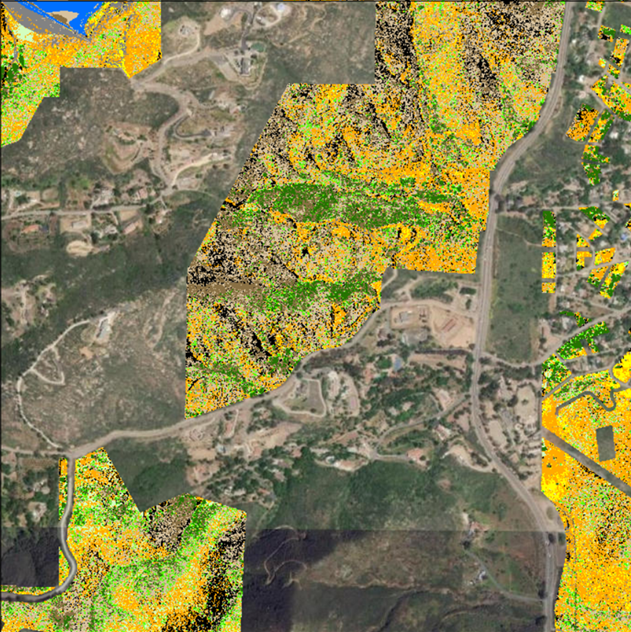
2023-2024 Coastal sage scrub and chaparral community monitoring for western San Diego County
Western San Diego County is dominated by shrublands supporting biologically diverse native plant and animal communities. Widespread urbanization has led to regional habitat loss and fragmentation and many species in these shrubland communities are rare, threatened, or endangered. Large-scale, multiple species conservation planning has resulted in a regional preserve system that focuses on these shrubland communities. A number of large-scale threats are leading to type conversion from shrub-dominated to non-native invasive annual grass-dominated vegetation. To understand the changes that are occurring to native shrublands, we have developed a vegetation monitoring program with several components at multiple spatial scales, focused on quantifying coastal sage scrub (CSS) and chaparral vegetation community characteristics. Several drivers of change associated with type conversion of native shrubland to non-native annual grassland have been identified by previous research including increasing fire frequency, nitrogen deposition from air pollution, and prolonged and intense drought associated with changing climate.
The objectives of this CSS and chaparral vegetation community monitoring plan are to:
1) Determine the distribution, composition, structure, and integrity of CSS and chaparral vegetation communities on conserved lands in western San Diego County,
2) Identify whether these attributes of the vegetation communities are changing over time, and
3) Evaluate relationships of known drivers of change (threats) and environmental factors in association with changes in vegetation community attributes.
The goal of this monitoring program is to classify CSS and chaparral vegetation community integrity, identify areas of degradation across western San Diego County, and characterize drivers, and environmental factors associated with loss of ecological integrity. A combination of vegetation mapping, landscape-scale remote sensing, and field plots will be used to address all the aspects of our research questions. Data compiled and collected will be available to conservation partners to help inform future management decisions.
|
|
An Adaptive Management Approach to Recovering Burrowing Owl Populations and Restoring a Grassland Ecosystem in San Diego County
San Diego Zoo Institute for Conservation Research (ICR), in partnership with multiple agencies, has developed an adaptive conservation management program to assist in the recovery of Western Burrowing Owls (BUOW; Athene cunicularia hypugaea) and their grassland ecosystem in San Diego County. Main objectives include (1) establishing more natural grassland ecosystems in San Diego County by re-establishing ground squirrels that provide critical resources for BUOW and valuable ecosystem engineering effects; (2) better understanding of the factors regulating BUOW population dynamics; (3) developing a comprehensive strategic management plan for BUOW in San Diego County; and (4) implementing the strategic management plan to begin establishing additional breeding nodes of burrowing owls. In 2017 ICR partnered with SDMMP to make publicly available a BUOW Conservation and Management Plan for San Diego County. This is a living document developed with input from local, state, and federal wildlife agencies, and will continue to be updated in the future.
|
|
Anstine-Audubon Nature Preserve Fencing Project
The goal of this project was to install 855 linear feet of lodge pole fencing along the northern boundary of San Diego Audubon Society’s (SDAS’s) 11.6-acre Anstine-Audubon Nature Preserve (Anstine) in Vista, CA to combat hazardous and non-hazardous dumping and illegal trespassing. The addition of fencing along the northern portion of the property, adjacent to Hidden Lake Lane, will protect the fragile riparian, oak woodland, and endangered coastal sage scrub habitats on the preserve. Urban Corps of San Diego, with SDAS oversight, successfully installed an 855-foot long, five-foot high lodge pole wooden fence along with three access gates on the property in the planned one-year project.
Project Start Date: March 7, 2023
Project Completion Date: January 18, 2024
This project was fully funded by SANDAG TransNet EMP Land Management Grant #S1125499
|
|
Coastal Cactus Wren Conservation Network
The Coastal Cactus Wren Conservation Network is an ad hoc group of more than 100 individuals representing research institutions, land management agencies, local government, non-profit conservation organizations and wildlife agencies. Members work together to exchange research and management information to develop best practices, policies, and programs that promote conservation and recovery of this bird throughout its range (Ventura, Los Angeles, San Bernardino, Orange, Riverside, and San Diego counties). This information will inform publication of a regional conservation strategy for the coastal cactus wren.
Cactus wrens (Campylorhynchus brunneicapillus) are distributed across the arid regions of the southwestern United States and northern and central Mexico (Hamilton et al. 2011). While the desert populations are fairly abundant, populations of coastal cactus wrens have declined dramatically over the past 30 years, with extirpation and genetic isolation affecting many locations as a result of habitat loss, habitat fragmentation, edge effects of development, and catastrophic fires (Solek and Szijj 2004). The coastal population is unique in that it occurs exclusively within the coastal sage scrub plant community, ranging from Ventura County south into San Diego County, U.S.A. and northwestern Baja California, Mexico. The firestorms of 2007 impacted several strongholds for the coastal cactus wren in Orange and San Diego counties. The significant loss of habitat and birds was the impetus for formation of the Coastal Cactus Wren Network.
For more information on the Coastal Cactus Wren Conservation Network, please see the document titled &quot;Coastal Cactus Wren Working Group Regional Goals, Objectives, and Strategies&quot;.
|
|
Famosa Slough Stormwater Treatment Pond Restoration and Enhancement
This project is designed to reduce the threat of altered hydrology and threat of loss of ecological integrity to the salt marsh vegetation community at Famosa Slough. In 2000, treatment ponds were built and vegetated at the south end of the Famosa Slough to clean all stormwater flows and retain dry-weather stormwater flows from the surrounding watershed of about 100 acres south of the Slough. The series of ponds and berms collect freshwater runoff as well as sediments, trash, and nutrients, but sediment has built up which reduces their effectiveness. The goal of this project is to restore the treatment ponds and berms and keep the dry weather freshwater and undesirable material from going into Famosa Slough, and thus reducing the risk of type conversion, and the resulting loss of ecological integrity of the strategic habitat of salt marsh vegetation community, and associated MSCP species. The treatment ponds are in urgent need of renovation to prevent the berms from failing and damaging the salt marsh habitat that is downstream. This project will remove sediment so that the dry weather freshwater is retained in the ponds rather than crossing the berm into the saltwater marsh areas, preserving the salt marsh.
|
|
Ocean Beach Estuary Enhancement Project
The project includes efforts to reduce threats to SO and SL species in the San Diego River estuary and allow human recreational use to coexist with high-quality habitat. The San Diego River estuary contains biologically valuable salt marsh and coastal dune habitats, which are increasingly rare in the region. Several SO and SL species occur in this project area including: salt marsh bird's beak, Nuttall's acmispon, western snowy plover, light-footed Ridgway's rail, and California least tern. The project will utilize management actions to minimize threats and encourage responsible human recreation including: improving access control through physical barriers to reduce threats of trampling, trash and illegal use, managing invasive weeds and planting native species to encourage pollinators of target native plant species, increasing community awareness through community education, and facilitating community investment with hands-on, meaningful volunteer projects, docent-led programs, and outreach, and growing a robust stewardship program to augment limited staff capacity for long-term maintenance of habitat and improvements.
This project is partially funded by SANDAG TransNet EMP Land Management Grant #S1125510
|
|
Pollinator Monitoring Plan
Declines of insects are being reported worldwide and includes several pollinator species in California. With reduced abundances and loss of species, there is a possibility that the ecosystem function of pollination is being compromised. The most common pollinators are Hymenoptera (bees and wasps), Coleoptera (beetles), Diptera (flies), and Lepidoptera (butterflies and moths). Overall, about 87 percent of plant species are pollinated by insects. San Diego Association of Governments TransNet Environmental Mitigation Program's Regional Management and Monitoring 2021-2022 and 2023-2024 workplans include objectives to improve wildlife movement. These objectives are based on the San Diego Management and Monitoring Program's Management and Monitoring Strategic Plan for Conserved Lands in Western San Diego County (MSP Roadmap; SDMMP and TNC 2017). Objectives for 2022-2026 are to prepare and implement a monitoring plan to survey pollinator communities and assess ecological integrity of pollinator functions in coastal sage scrub, chaparral, forblands and grasslands across the MSP Area. This project will prepare pollinator data in 2021 for analysis in 2022 and development of a pollinator monitoring pilot study plan in 2023 to be implemented in 2024. This plan is being prepared in conjunction with a coastal sage scrub, chaparral, and grassland vegetation monitoring plan. Pollinator sampling locations will be co-located at vegetation sampling plots.
|
|
SAN DIEGO THORNMINT ENHANCEMENT PROJECT
Project will expand and enhance three populations of San Diego thornmint (ACIL) on San Diego Habitat Conservancy managed properties. Project main goals are to improve ACIL habitat, and increase the ACIL seed bank to reduce the likelihood of extirpation. This project is partially funded by SANDAG TransNet EMP Land Management Grant #S1125501.
|
|
San Dieguito Citizen Science Monitoring Program
The San Dieguito River Valley Conservancy (SDRVC) developed the San Dieguito Citizen Science Monitoring Program as a sustainable, cost-effective, and scientifically valid approach to gather critical data on lands within the San Dieguito River Park Focused Planning Area. This program seeks to fill knowledge gaps on the diversity, population, movements and spatial ecology of species within the watershed to better inform future land acquisitions, adaptive land management, habitat and species restoration, educational initiatives and future research. One of the main objectives of this program is to gather data that is consistent and shared with other regional planning efforts being coordinated by the San Diego Management & Monitoring Program. Data collected is submitted to regional databases and will help meet the management goals and objectives identified in the Management & Monitoring Strategic Plan. Annual expert-led surveys are carried out by volunteer citizen scientists following approved protocols and encourage community involvement and engagement.
|
|
SDMMP Summary of Achievements 2008-2024
As a program, SDMMP has regionally monitored 52 species and regionally surveyed 68 species across all taxa; monitored and/or mapped 8 vegetation communities; and modeled, assessed, and mapped 8 threats and stressors. Additionally, the SDMMP has completed 27 genetic studies, 80 research studies, 18 habitat models, and interacted with more than 75 partner groups. The table provided breaks down management and monitoring tasks that have been completed by species, vegetation community, and threats.
|
| File name | Lead Author | Year | Type |
|---|---|---|---|
| City of Carlsbad Wildlife Movement Analysis Final Report 2015 | 2015 | report | |
| Mission Bay Park Conservation Program: Habitat Assessment, Invasive Control, and Community-Based Habitat Restoration | Redfern, Chris | 2013 | powerpoint presentation |
| Vegetation Height in Open Space in San Diego County, Derived from 2014 NAIP Imagery and 2014/2015 Lidar | Perkins, Emily | GIS data |