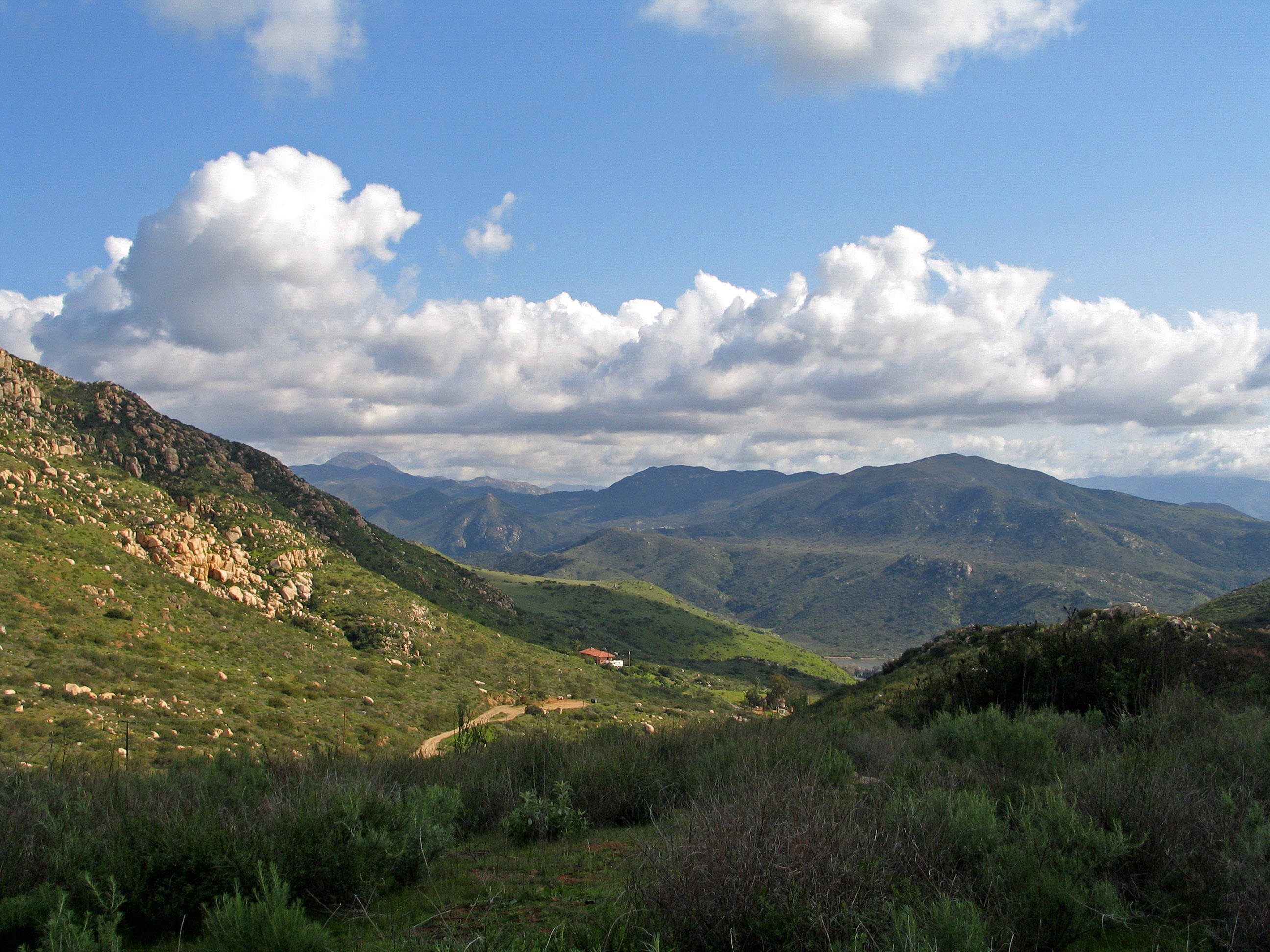
South Crest Preserve
Photo Credit: Patricia Gordon-Reedy, CBI
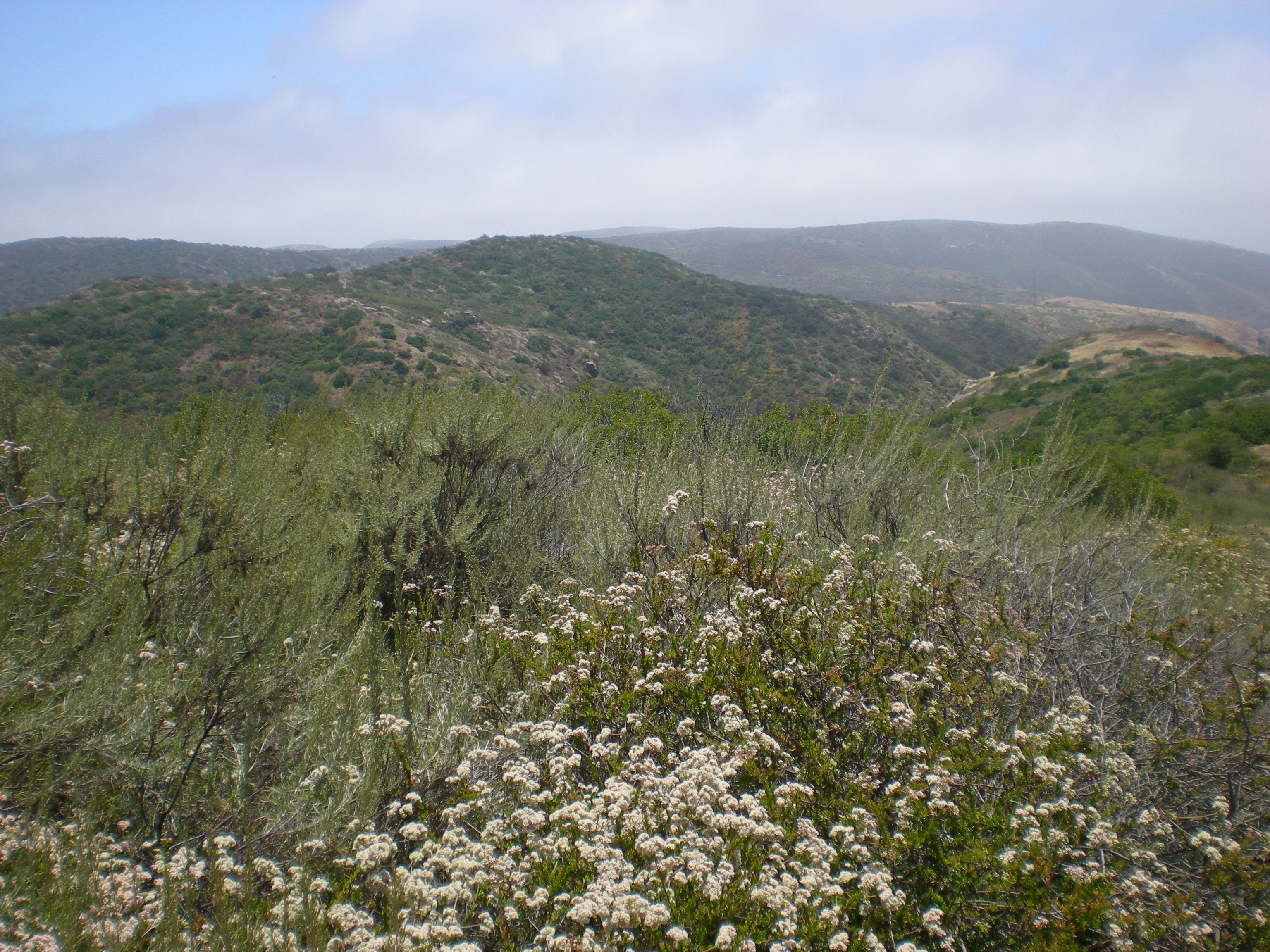
Photo Credit: Kris Preston, SDMMP
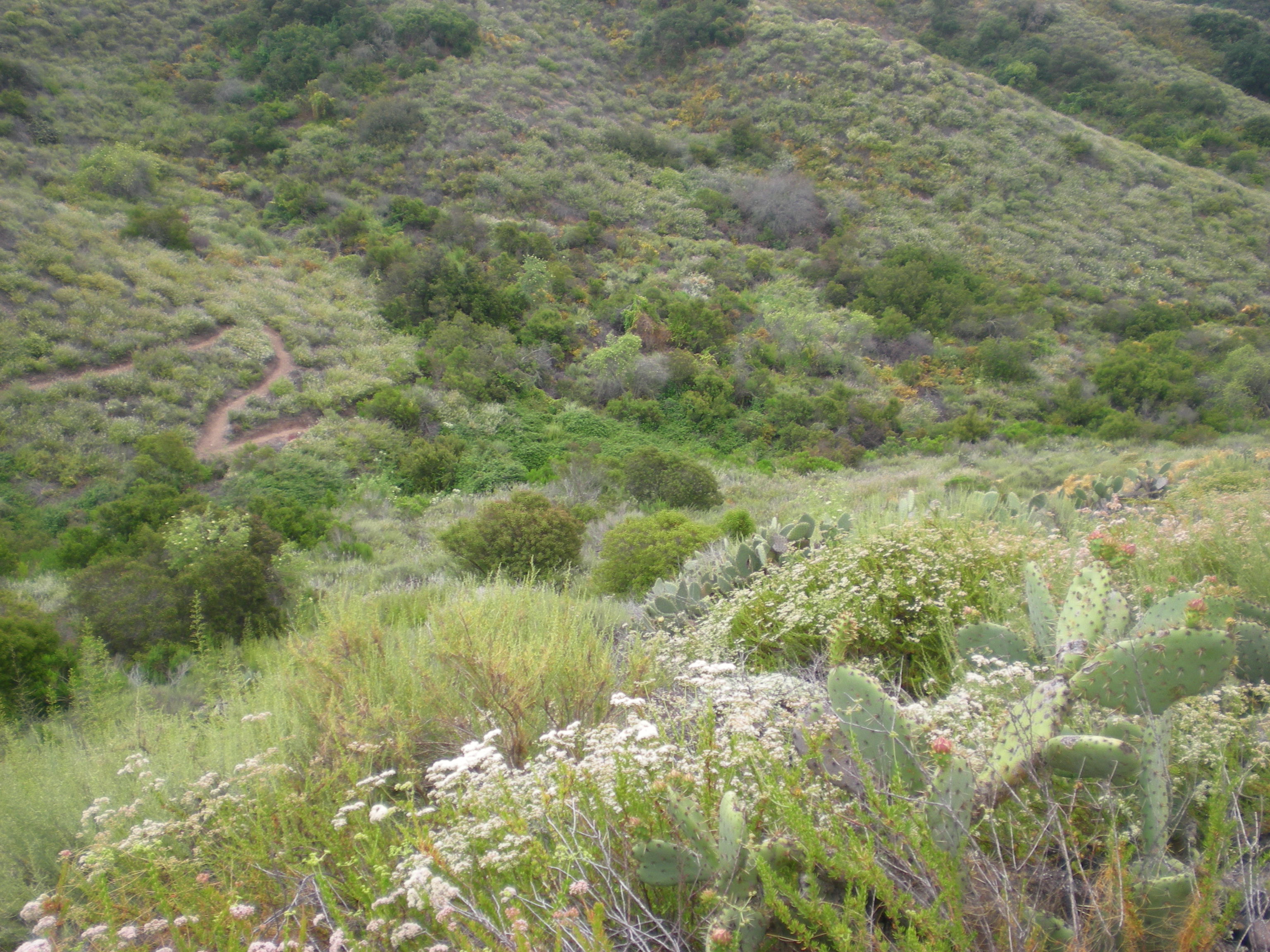
Photo Credit: Kris Preston, SDMMP
Goal: Maintain, enhance and restore coastal sage scrub on Conserved Lands in the MSPA that supports or has the potential to support VF species (i.e., cliff spurge, Palmer's goldenbush, San Diego barrel cactus, snake cholla, Blaineville's horned lizard, California gnatcatcher, San Diego black-tailed jackrabbit) and to incidentally benefit a diverse array of other species (e.g., San Diego thornmint, Hermes copper, Quino checkerspot, coastal cactus wren) so that the vegetation community has high ecological integrity, and these species are resilient to environmental stochasticity, catastrophic disturbances and threats, such as very large wildfires, invasive plants and prolonged drought, and will be likely to persist over the long term (>100 years).
Management units: 1, 2, 3, 4, 5, 6, 7, 8, 9, 10, 11
In 2017, prepare a long-term monitoring plan for the mosaic of chaparral, coastal sage scrub and grassland vegetation communities that focuses on tracking community composition, structure and ecological integrity over time in relation to climate (i.e., drought) and disturbance from fire. The monitoring plan should include a conceptual model, specific monitoring questions, the sampling frame within the MSPA, monitoring methods, a statistically valid sampling design, permanent sampling locations, timeline, and standardized protocols. Use the landscape-scale ecological integrity classification map to develop a sampling frame and the sampling design with permanent sampling plots spanning north to south and east to west environmental gradients across the MSPA. Evaluate how the vegetation integrity classes characterize other aspects of the ecosystem by integrating other types of monitoring into the long-term sampling plots, such as abiotic element monitoring (e.g., automated weather stations and soil sensors, GIS-data layers), ecological integrity monitoring (e.g., plant and animal communities, ecological processes), MSP VF species monitoring, and threats monitoring (e.g., fire, climate change, invasive plants). A draft monitoring plan should be prepared in 2017, tested in the field with a pilot study in 2018, and finalized by 2019.
| Action | Statement | Action status | Projects |
|---|---|---|---|
| PRP-1 | Establish a vegetation monitoring working group of scientists, wildlife agencies, land managers, and other stakeholders to participate in developing the vegetation monitoring plan. The group should also include interested parties from outside the MSPA, such as representatives from other multiple species plans in Orange and Riverside Counties and from San Diego County military bases, to create a regional monitoring program with greater efficiencies in effort and a broader inference across southern California. | In progress | |
| PRP-2 | Submit project metadata, datasets, analyses, and Chaparral, Coastal Sage Scrub, and Grassland Vegetation Monitoring Plan to the MSP web portal | In progress |
| Criteria | Deadline year |
|---|---|
| Chaparral, Coastal Sage Scrub and Grassland Vegetation Monitoring Plan completed by 2019 | 2021 |
| Threat Name | Threat Code |
|---|---|
| Altered fire regime | ALTFIR |
| Climate change | CLICHN |
| Invasive plants | INVPLA |
| Loss of ecological integrity | ECOINT |
Management units: 1, 2, 3, 4, 5, 6, 7, 8, 9, 10, 11
In 2017, develop a landscape-scale map classifying ecological integrity of shrublands across the MSPA based upon shrub cover and density and invasive nonnative annual grasses using remote imagery (e.g., satellite and high resolution aerial imagery, LIDAR) and vegetation data collected during 2015-2016 California gnatcatcher regional and postfire monitoring. Verify and revise the mapping as needed using field data collected in 2018-2020 as part of the Chaparral, Coastal Sage Scrub and Grassland Monitoring Program and from related VF species monitoring (e.g., California gnatcatcher regional and postfire monitoring). Revise the integrity classification map as needed to respond to changes in vegetation based upon wildfires, drought or other large-scale disturbances.
| Action | Statement | Action status | Projects |
|---|---|---|---|
| DEV-1 | Submit project metadata, datasets, analyses, and Ecological Integrity Classification Map to the MSP web portal | In progress | 2017-2019 Developing a Map of Ecological Integrity Using Remote Sensing, 2023-2024 Coastal sage scrub and chaparral community monitoring for western San Diego County |
| Criteria | Deadline year |
|---|---|
| Ecological Integrity Map created in 2017 and updated as needed 2018-2021 | 2021 |
| Threat Name | Threat Code |
|---|---|
| Altered fire regime | ALTFIR |
| Climate change | CLICHN |
| Invasive plants | INVPLA |
| Loss of ecological integrity | ECOINT |
Management units: 1, 2, 3, 4, 5, 6, 7, 8, 9, 10, 11
In 2018, conduct pilot monitoring to collect data and develop any recommendations for finalizing the monitoring plan. From 2019 to 2021, implement the final Chaparral, Coastal Sage Scrub and Grassland Vegetation Monitoring Plan.
| Action | Statement | Action status | Projects |
|---|---|---|---|
| IMP-1 | Submit project metadata, monitoring datasets and reports to the MSP web portal | waiting for precedent action | 2023-2024 Coastal sage scrub and chaparral community monitoring for western San Diego County |
| Criteria | Deadline year |
|---|---|
| Chaparral, Coastal Sage Scrub and Grassland Vegetation Monitoring Plan implemented 2018-2021 | 2021 |
| Threat Name | Threat Code |
|---|---|
| Altered fire regime | ALTFIR |
| Climate change | CLICHN |
| Invasive plants | INVPLA |
| Loss of ecological integrity | ECOINT |
Management units: 3, 4, 5, 6, 8, 9, 10, 11
Beginning in 2019, prepare a plan to test the use of grazing, prescribed fire and other methods of landscape-scale control of invasive grasses and forbs in grassland and coastal sage scrub vegetation communities as BMPs to promote MSP species, native plants and animals, and natural ecosystem processes. The plan should determine the effects of different techniques on natural resources at 200 acre treatment areas at 3 different sites in the MSPA. Development of the study plan's experimental approach should include a review of the literature on the effects of grazing, prescribed fire, and other methods of invasive plant control on coastal sage scrub and grassland ecosystems to develop a conceptual model for management and monitoring. The plan should detail how to test different plant control methods over at least 3 years and should include the specific monitoring questions, objectives, and monitoring targets, a statistically valid experimental design with monitoring methods, sampling locations, and standardized protocols. The plan should include annual monitoring to determine the benefits and impacts of each method on natural resources and to track financial costs, logistics and sustainability of invasive plant control.
| Action | Statement | Action status | Projects |
|---|---|---|---|
| PRP-1 | Work with land managers, wildlife agencies, and scientists to determine: methods of landscape-scale invasive plant control to test in coastal sage scrub and grassland ecosystems; locations for testing methods; monitoring targets including MSP species, native plant and animal taxa, and ecological processes; and review of results and development of long-term management and monitoring methods. See COSASC-5 actions for additional information to include in the plan. | on hold | Regional Grazing Monitoring Plan |
| Criteria | Deadline year |
|---|---|
| Plan to Test Landscape-scale Invasive Plant Control of Coastal Sage Scrub and Grassland Ecosystems Completed in 2020 | 2021 |
| Threat Name | Threat Code |
|---|---|
| Altered fire regime | ALTFIR |
| Climate change | CLICHN |
| Invasive plants | INVPLA |
| Loss of ecological integrity | ECOINT |
Management units: 3, 4, 5, 6, 8, 9, 10, 11
In 2020-2021, begin implementing and testing the plan for landscape-scale invasive plant control of coastal sage scrub and grassland ecosystems at 3 or more selected sites with extensive (at least 200 acres) coastal sage scrub and grasslands with large nonnative grass component, using livestock that are most suitable and feasible to manage for the grazing study, effective at controlling invasive nonnative annual grasses, and that are least likely to impact native plant and animal species. Test management methods for enhancing coastal sage scrub to reduce invasive plants and to increase native forb, grass and shrub cover and bare ground. Test management techniques for nonnnative grassland to improve habitat for MSP species such as Quino checkerspot, burrowing owl, golden eagle, grasshopper sparrow, black-tailed jackrabbit and American badger. Incorporate layered treatments of different control methods in the experimental design.
| Action | Statement | Action status | Projects |
|---|---|---|---|
| DEV-1 | Initiate adaptive management at 3 or more selected sites with extensive areas (≥200 acres) of coastal sage scrub and grasslands with a large nonnative annual grass component. Test management methods for enhancing coastal sage scrub to reduce invasive plants and to increase native forb, grass and shrub cover and bare ground. Test management techniques for nonnnative grassland to improve habitat for MSP species such as Quino checkerspot, burrowing owl, golden eagle, grasshopper sparrow, black-tailed jackrabbit and American badger. Incorporate layered treatments of different control methods in the experimental design | on hold | |
| DEV-2 | Select livestock species to use in the grazing study that are most feasible to manage, effective at controlling invasive non-native annual grasses, and that are least likely to impact native plant and animal species. | on hold | Regional Grazing Monitoring Plan |
| DEV-3 | Conduct experimental trials at multiple sites with sufficient replicates to evaluate the timing and duration of prescribed fire, grazing, stocking rates, and frequency of grazing over =3 years with varying amounts and timing of precipitation. | on hold | Regional Grazing Monitoring Plan |
| DEV-4 | Include in the experimental design different seeding trials to determine the combination of invasive plant control and re-seeding techniques that results in the most effective restoration outcomes. | on hold | |
| DEV-5 | Monitor plant community composition and cover to determine if grazing effectively controls non-native annual grasses, forbs and alters native plant community composition, structure, and cover. | on hold | Regional Grazing Monitoring Plan |
| DEV-6 | Collect covariates to evaluate impacts of grazing, prescribed fire and other control methods to native plant and animal species and to ecosystem processes. | on hold | Regional Grazing Monitoring Plan |
| DEV-7 | Compare results of grazing, prescribed fire with South County Grassland study results to control invasive grasses and forbs using herbicides and mechanical treatments. | on hold | |
| DEV-8 | If utilizing grazing, presecribed fire or other methods or combination of methods to manage annual grass in coastal sage scrub achieves the desired outcomes and does not have unintended consequences (introduction and or expansion of invasive species, change in shrub structure, impact to native plants and animals or ecological processesetc.) on the coastal sage scrub and grassland vegetation communities and it is cost effective, develop a BMP as a management tool. If a BMP is developed it should include specific guidelines on how to use grazing, fire and/or other methods as a management tool and the costs to utilize it. | on hold | |
| DEV-9 | Submit project metadata, monitoring datasets and report to the MSP web portal | on hold |
| Threat Name | Threat Code |
|---|---|
| Altered fire regime | ALTFIR |
| Climate change | CLICHN |
| Invasive plants | INVPLA |
| Loss of ecological integrity | ECOINT |
| Metric | Condition | Trend | Confidence |
|---|---|---|---|
1. Percent ConservedPercent of baseline coastal sage scrub conserved |
Caution |
Improving |
Moderate |
2. Ecological IntegrityPercent of coastal sage scrub in high integrity class based on the percent shrub cover |
Significant Concern |
Unknown |
Moderate |
3. Fire FrequencyPercent of coastal sage scrub that has burned 2 or more times in a 30-year period |
Significant Concern |
Declining |
Moderate |
|
2005-2007 Prioritizing and Creating Conceptual Models for MSCP Species
This project was completed for California Department of Fish and Game Local Assistance Grant #P0450009, which assessed and improved the San Diego Multiple Species Conservation Program Biological Monitoring Plan. This project was a modular effort and included critical assessments and research on 1) the implementation of the monitoring program to date and information relevant to successful monitoring program design 2) prioritization of MSCP species based on threat, 3) prioritization of ecological communities based on extent and representation, and 4) development of conceptual models to aid monitoring and management. These steps follow the monitoring program design described in Atkinson et al. 2004 which can be found at: https://sdmmp.com/view_article.php?cid=CID_jmolden%40usgs.gov_57acfadf298c1.
|
|
2008-2010 Evaluating Vegetation Data Collection Methods
The objective of this NCCP Local Assistance Grant and SANDAG EMP funded project is to evaluate different sampling designs and field protocols for monitoring coastal sage scrub (CSS) and chaparral vegetation communities. This effort addresses one of the two broad goals of the monitoring program, namely monitoring biodiversity and ecosystem function. The objective of this project is to evaluate the cost and accuracy of different sampling designs and field protocols for monitoring coastal sage scrub (CSS) and chaparral vegetation. This project builds on the Franklin, Regan and Deutschman LAG project funded by CDFG (Agreement #P0450009) and complements two other LAG grants. These projects include a review of the rare plant monitoring program for the MSCP by McEachern et al. (Agreement # P0350011) and a review of the animal monitoring portion of the MSCP by the USFWS (Agreement #P0585100). This report follows and elaborates on ideas presented in two earlier reports submitted to CA DFG (Deutschman, Franklin, and Lewison - Agreement # P0685105; Deutschman - Agreement # P0782006).
|
|
2008-2011 Evaluating Remote Sensing Methods for Vegetation Monitoring
Identifying habitats that should be protected from further disturbance or conversion and isolating high-risk areas is a focus of community habitat plans in southern California shrublands. Larger wildfires are occurring at shorter intervals in recent decades, contributing to degradation and conversion of shrubland vegetation. Multitemporal remote-sensing approaches can bridge the gap between vegetation mapping and field sampling in habitats where frequent quantification and mapping of vegetation growth forms over large extents is required. The objective of this study is to examine the reliability and stability of a multiple endmember spectral mixture analysis (MESMA) approach with moderate spatial resolution imagery for monitoring changes in growth form fractional cover in shrubland habitats. Estimates from visual interpretation of high spatial resolution image were used as reference data for validating MESMA-derived maps and as basis for providing complementary monitoring protocols that may be accurate and cost-effective across multiple scales. Growth form proportions modelled in burned and unburned management areas compare well with expected fractional cover in mature and regenerating shrublands. In themanagement areas recovering from fire, herbaceous cover fraction exceeded 0.40 for all three study dates, suggesting that large portions of those management areas may already be invaded. From 2008 to 2011 overall herbaceous cover fraction in shrubland area increased by 2%. Herbaceous cover fraction was modelled with an overall mean absolute error (MAE) of 0.08, a smaller percentage than the percentage of herbaceous cover change recorded in areas recovering from fire (increase in herbaceous cover fraction from 0.09 to 0.13). This MESMA approach would be effective for quantifying changes in fractional cover that exceed 0.10, providing a way to delineate and quantify herbaceous invasions and expansions following disturbance or succession.
|
|
2010-2012 Refining Research Objectives and Data Collection Methods
A new phase of the vegetation monitoring program began in 2010. After several years focused on data collection and analysis, this project focused on closing the feedback loop as envisioned in Atkinson et al. 2004. Work involved a wide array of stakeholders to revise and update the goals and objectives of the monitoring and management plans, develop conceptual models for individual preserves, and adapt and apply management plans on individual preserves. One aspect of this work was a structured workshop. The workshop, based on the Dahlem model, was the first concrete step in facilitating collaborative decision making.
|
|
2017-2019 Developing a Map of Ecological Integrity Using Remote Sensing
This project's objective is to create a map of ecological integrity using remotely sensed data. Data sources include high resolution lidar and high resolution 4-band imagery from multiple sources. Final products from this work will include: 1) an updated high resolution Digital Elevation Model, 2) an updated high resolution Digital Surface Model, 3) a raster image depicting vegetation height (using lidar), 4) a raster image depicting herbaceous, shrub, and tree cover, 5) a map layer of ecological integrity (at a 50m grid) for coastal sage scrub, chaparral, oak woodlands, and riparian woodlands. Ecological integrity is defined for each vegetation community independently, based on analysis of previous field work. This project will build off the information and products previously created.
|
|
2023-2024 Coastal sage scrub and chaparral community monitoring for western San Diego County
Western San Diego County is dominated by shrublands supporting biologically diverse native plant and animal communities. Widespread urbanization has led to regional habitat loss and fragmentation and many species in these shrubland communities are rare, threatened, or endangered. Large-scale, multiple species conservation planning has resulted in a regional preserve system that focuses on these shrubland communities. A number of large-scale threats are leading to type conversion from shrub-dominated to non-native invasive annual grass-dominated vegetation. To understand the changes that are occurring to native shrublands, we have developed a vegetation monitoring program with several components at multiple spatial scales, focused on quantifying coastal sage scrub (CSS) and chaparral vegetation community characteristics. Several drivers of change associated with type conversion of native shrubland to non-native annual grassland have been identified by previous research including increasing fire frequency, nitrogen deposition from air pollution, and prolonged and intense drought associated with changing climate.
The objectives of this CSS and chaparral vegetation community monitoring plan are to:
1) Determine the distribution, composition, structure, and integrity of CSS and chaparral vegetation communities on conserved lands in western San Diego County,
2) Identify whether these attributes of the vegetation communities are changing over time, and
3) Evaluate relationships of known drivers of change (threats) and environmental factors in association with changes in vegetation community attributes.
The goal of this monitoring program is to classify CSS and chaparral vegetation community integrity, identify areas of degradation across western San Diego County, and characterize drivers, and environmental factors associated with loss of ecological integrity. A combination of vegetation mapping, landscape-scale remote sensing, and field plots will be used to address all the aspects of our research questions. Data compiled and collected will be available to conservation partners to help inform future management decisions.
|
|
American Badger Research and Monitoring
Badgers have been identified by the San Diego Monitoring and Management Program Connectivity Monitoring Strategic Plan as a target species for monitoring regional-scale functional connectivity of upland and grassland habitats. However, prior to these studies there was little information on badger distribution, movement, or habitat use within San Diego County. In 2011, the California Department of Fish and Game Local Assistance Grant funded an initial study to determine if badgers still persist in the western portion of San Diego County. Canine scent surveys were conducted for American badger scat from November 14-December 14, 2011. Thirty-two sites in San Diego County and two sites in southern Riverside County were surveyed. The scent dog had positive behavioral responses to scat at 13 sites, and a badger specific DNA test verified the scat collected at twelve sites. A recommendation from the 2011 study led researchers to develop a microsatellite DNA test to identify individual animals from scat. This would allow for estimation of minimum population sizes in areas with multiple scats. In 2014, a follow up study was conducted to the initial 2011 rapid assessment for the American badger. The objectives were to identify target areas with potentially higher densities of badgers and to better assess the level of connectivity between known occupied areas. Thirty canine scent surveys for badger scat were conducted. This study involved: 1) additional focused surveys to identify areas occupied by badgers, and 2) determination of the number of badgers at various locations using genetic tests of scat or hair to identify individuals. In 2015, researchers continued studies of the spatial and temporal use of habitats by the American badger by conducting monthly field sign and infrared camera surveys across seven focal sites in the County where we previously documented substantial and/or repeated badger activity. The objective was to determine if badger use is irregular, seasonal, or consistent. American badgers were active at two of the seven focal sites in 2015, the upper San Diego River at El Capitan Grande Reservation and Rancho Guejito. From 2011 to present, researchers established that the American badger currently occupies or uses conserved lands within MSCP and MHCP and many other portions of the county.
|
|
Anstine-Audubon Nature Preserve Fencing Project
The goal of this project was to install 855 linear feet of lodge pole fencing along the northern boundary of San Diego Audubon Society’s (SDAS’s) 11.6-acre Anstine-Audubon Nature Preserve (Anstine) in Vista, CA to combat hazardous and non-hazardous dumping and illegal trespassing. The addition of fencing along the northern portion of the property, adjacent to Hidden Lake Lane, will protect the fragile riparian, oak woodland, and endangered coastal sage scrub habitats on the preserve. Urban Corps of San Diego, with SDAS oversight, successfully installed an 855-foot long, five-foot high lodge pole wooden fence along with three access gates on the property in the planned one-year project.
Project Start Date: March 7, 2023
Project Completion Date: January 18, 2024
This project was fully funded by SANDAG TransNet EMP Land Management Grant #S1125499
|
|
Artesian Creek Restoration
Approximately 300 acres along Artesian Creek, a tributary of the San Dieguito River, was restored to coastal sage or native riparian. The majority of restored land was previously used for grazing, with an additional two miles of riparian habitat. The project is located between Camino Del Sur and Del Dios Highway, just south and southwest of Lake Hodges. The restoration has been completed, but annual treatment of invasive species remains including ongoing treatment of eucalyptus, tamarix and palms. The focal invasive species included: mustard, French broom, Scotch broom, Spanish Fleabane, arundo, Austrailian salt bush, Brazilian Pepper, caster bean, lapidium latifolia, garland chrysanthemum, bridal creeper, Italian thistle, fountain grass, dittrichia graveolens, artichoke, eucalyptus, tree tobacco, acacia, palms, pampas grass, pride of Maderia, tamarix, and fennel.
|
|
Blaineville's Horned Lizard Genetics Study
The proposed study will provide data on whether coast horned lizard populations are genetically interconnected across the NCCP reserve system, or whether gene flow has occurred recently but is no longer possible due to habitat fragmentation.
|
|
Blue Sky Ecological Reserve Fire Restoration and Invasive Removal
Blue Sky Ecological Reserve burned in 2007. In 2008, restoration focused on the removal of Castor bean, mustard, tree tobacco palms, dittrichia, fountain grass, acacia, cape ivy, tamarix and pampas grass. Major restoration efforts concluded after 3 years. Maintenance has continued with the treatment of Castor bean and Italian thistle.
|
|
Brachypodium Control
This project used a science-based, experimental approach to develop treatment and restoration
strategies for the emerging invasive grass, Brachypodium distachyon (Brachypodium), on
conserved lands in southern San Diego County, CA. Phase I (2013-2015) included conceptual
models to inform experimentally-based treatment and restoration strategies; experimental
treatments (dethatching, herbicide, mechanical removal), monitoring, and seed collection,
bulking, and outplanting. Treatments continued in Phase II (2016-2017), using the most
effective management strategy (herbicide). See the Phase I and II reports for study results and
Best Management Practices (BMPs) for Brachypodium control. Herbicide is the most effective
treatment for controlling Brachypodium but timing of treatment is critical and multiple
treatments may be required in a single year, depending on rainfall and temperature. Herbicide
treatment of forbs becomes increasingly important as cover of Brachypodium and other
nonnative grasses decrease. Dethatching improves treatment effectiveness and stimulates the
soil seedbank (if present). The experimental design was coordinated with SDMMP and the City
of San Diego, and results may contribute to a regional analysis of Brachypodium control across
multiple sites, habitats, and microclimates.
|
| Cactus Wren Foraging and Invertebrates Study |
|
Cactus Wren Genetic Analysis - Historical Museum Samples
The purpose of this study is to gather genetic data from museum samples collected in the early 1900s to compare levels of genetic diversity and population structure to present day estimates. From this analysis, USGS hopes to determine whether there has been an increase in population genetic differentiation and a loss of genetic diversity in Southern California Cactus Wrens over the past century, and to quantify these changes. Results will help inform potential management actions such as choosing source populations for re-establishment and augmentation.
This project will consist of the following objectives:1) Develop protocols for DNA extraction and amplification of historical museum samples for microsatellite loci; 2) Travel to museums in California to retrieve tissue from relevant museum specimens; 3) Genotype samples, analyze patterns of genetic differentiation and diversity, and prepare a report comparing past to present population genetic structure.
|
|
Cactus Wren Genetic Study - Regional
This study analyzes genetic population structure in the cactus wren throughout coastal southern California using microsatellite markers developed specifically for this species. It expands upon a previous study focused in Orange and San Diego Counties (Barr et al. 2012), adding cactus wren samples from Ventura, Los Angeles, San Bernardino, and Riverside Counties. Additional samples from Palos Verdes and West Coyote Hills were included in the original dataset in an addendum to the study. With this full dataset, we characterize the current population genetic structure to provide information on levels of gene flow throughout the cactus wren's range in coastal southern California. We also analyze genetic diversity and recent demographic change over the study area. Understanding these patterns will aid in management of current cactus wren populations and future efforts in habitat restoration.
|
|
Cactus Wren Genetic Study - San Diego and Orange County
Among the possible consequences of fragmentation for cactus wren viability is genetic isolation, which could lead to loss of genetic variability and ability to adapt to changing environments. In 2011, USGS scientists Barbara Kus and Amy Vandergast initiated a collaborative study to examine genetic population structure of coastal cactus wrens throughout their southern California range. In this study, researchers describe genetic connectivity in the coastal cactus wren in San Diego County. To gain a broader perspective, they also obtained samples from the Nature Reserve of orange County, where many of the remaining coastal cactus wrens are found in that county. These data provide excellent resolution for describing current population structure in the species, reveal the gene flow regime, and provide insight on current levels of genetic diversity within populations. Understanding these patterns will aid in management of current coastal cactus wrens populations and future efforts in habitat restoration.
From this study, scientists found coastal cactus wrens to be highly isolated from one another in their southern California range(Barr et al. 2015). These results prompted management actions to attempt to restore connectivity among cactus wren populations, including habitat protection and restoration. The goal of Subtask 4.2 is to repeat the 2011 genetics study in the Otay, Sweetwater/San Diego and San Pasqual Valley genetic clusters. Specifically, the objectives are to:
1) Determine whether genetic diversity and effective population size have changed in the intervening 6 years with management to increase cactus scrub and improve connectivity, or in response to drought-associated population declines.
2)Prepare recommendations for managing gene flow and/or population expansion to enhance genetic diversity and effective population size.
|
|
Cactus Wren Habitat Conservation and Management Plan (2015)
The Cactus Wren Habitat Conservation and Management Plan was prepared in 2015 to help fulfill MSP Roadmap Goals and Objectives established for management of the Coastal Cactus Wren in the Otay genetic cluster. This plan identified and prioritized management and restoration needs for the cactus wren in this genetic cluster, and also assessed connectivity to core habitat areas on Conserved Lands within the Sweetwater and Lake Jennings genetic clusters to further ensure persistence of the cactus wren in southern San Diego County over the next 100 years.
|
|
Cactus Wren Occupancy Study and Cactus Patch Mapping
Given the extent and severity of the 2003 and 2007 wildfires in San Diego County there is an increase cause for concern in understanding the amount of available habitat and the percent of that habitat that is occupied by the coastal cactus wren. The USFWS has developed and refined a protocol for conducting coastal cactus wren monitoring. USFWS tested the protocol by completing surveys in 2009 and 2010. All southwest and southeast facing slopes below 1,500 feet, within San Diego MSCP preserve lands, were mapped for the occurrence of cactus patches. Once cactus patches were mapped in GIS, these patches were segmented into plots and surveyed for cactus wrens.
|
|
Calavera Preserve Planning Area Access Control and Habitat Restoration Project
The Restoration Project was implemented in accordance with the Diegan Coastal Sage Scrub Restoration Plan, TransNet EMP Grant Project: Calavera Preserve Planning Area (Restoration Plan), which was prepared by Technology Associates, Inc. (TAIC) (Aug. 24, 2009). The goal of the project was to restore 5 acres of non-native grassland habitat to Diegan coastal sage scrub that is (a) self-sustaining, (b) suitable habitat for the California gnatcatcher, and (3) free of non-native invasive species that could invade adjacent native habitat. In addition to habitat restoration, the City of Carlsbad had an active public outreach program highlighting the benefits of natural open spaces throughout the city.
|
|
California Gnatcatcher Genetic Study - FundSource 1 and 2
We examined individual relatedness patterns and population genetic structure among gnatcatcher aggregations throughout coastal southern California from Ventura to San Diego Counties. To accomplish this goal, we developed a set of highly polymorphic microsatellite loci and sampled 268 individuals throughout the range. With genetic analyses we addressed the following questions:1) How many genetically distinguishable populations exist across the U.S. species range?2) Is genetic relatedness among individuals explained by the amount and distribution of suitable habitat?3) What is the range of dispersal distances between presumptive siblings and parents/offspring?4) What are the patterns of genetic diversity within aggregations across the U.S. range and what is the effective population size?5) How do these results impact future management and monitoring efforts aimed at species recovery?
|
|
California Gnatcatcher Post-Fire Study
This is a planned 5-year study. The purpose of this study is to: 1) Determine whether there has been further recovery of CAGN in areas burned in 2003 (i.e., occupancy greater than 10%). 2) Determine if there is a difference in CAGN occupancy between areas burned in 2003, 2007, and 2014. 3) Determine the relationship between CAGN occupancy and vegetation composition, cover and structure. 4) Determine the composition, cover, and structure of CSS vegetation in areas with different fire histories and evaluate patterns of vegetation recovery based upon lime since fire, spatial distribution, previous land use, and environmental conditions.
|
|
California Gnatcatcher South Coast Regional Monitoring Program
The USGS, USFWS, SDMMP, and the Nature Reserve of Orange County have joined together to develop a long-term coordinated regional monitoring program for the federally-threatened Coastal California Gnatcatcher (Polioptila californica californica) in the United States portion of the species range. Other participants include CDFW, The Nature Conservancy, Western Riverside RCA, Rancho Mission Viejo Conservancy, Naval Weapons Station Fallbrook, Marine Corp Base Camp Pendleton, Marine Corp Air Station Miramar. The goals of this program are to: 1) determine the population status of California Gnatcatchers in southern California on conserved and military lands; 2) track trends in California Gnatcatcher habitat occupancy over time in southern California to identify when thresholds have been met that trigger management actions; and 3) identify habitat attributes and threats associated with gnatcatcher occupancy in order to develop specific habitat-based management criteria and recommendations. To date, there have been no systematic surveys for this species across southern California. Surveys have been conducted periodically in portions of the gnatcatcher's range, particularly on conserved and military lands. However, these surveys have been conducted in different years and with a variety of methods providing different population metrics and as a result do not provide a region-wide estimate. In addition, during the last 15 years, there have been extremely large wildfires in southern California across a substantial portion of suitable habitat for gnatcatchers and there is little information on their status in these burned areas.
The first regional Coastal California Gnatcatcher survey is scheduled for 2016. This survey is planned for conserved lands and those military lands in southern California that choose to participate. The objectives of the regional monitoring program are:
1. In 2016, determine the percent area occupied (PAO) by California Gnatcatchers in modeled high and very high suitability habitat on conserved lands and on participating military lands in southern California.
2. Over the next 15 years, determine long-term trends in California Gnatcatcher PAO and in their colonization and extinction rates in modeled high and very high suitability habitat on conserved lands and participating military lands in southern California and be able to detect at least 30% change in California Gnatcatcher PAO.
3. Beginning in 2016, identify associations between habitat and threat correlates with California Gnatcatcher PAO and with colonization and extinction rates in order to develop biologically meaningful thresholds for management and to specify management criteria and recommendations.
|
|
Chula Vista Cactus Wren Habitat Restoration and Enhancement Program
A 5-year restoration and enhancement project designed to maintain and increase suitable habitat for the cactus wren in the City of Chula Vista's Central City Preserve. The goal of this program is to ensure the prolongation of the coastal cactus wren through active management of suitable cactus wren habitat, restore degraded and/or fragmented cholla patches, and initiate activities to reduce edge effects associated with invasive species, uncontrolled access and risk of fire.
|
|
Coastal Cactus Wren Conservation Network
The Coastal Cactus Wren Conservation Network is an ad hoc group of more than 100 individuals representing research institutions, land management agencies, local government, non-profit conservation organizations and wildlife agencies. Members work together to exchange research and management information to develop best practices, policies, and programs that promote conservation and recovery of this bird throughout its range (Ventura, Los Angeles, San Bernardino, Orange, Riverside, and San Diego counties). This information will inform publication of a regional conservation strategy for the coastal cactus wren.
Cactus wrens (Campylorhynchus brunneicapillus) are distributed across the arid regions of the southwestern United States and northern and central Mexico (Hamilton et al. 2011). While the desert populations are fairly abundant, populations of coastal cactus wrens have declined dramatically over the past 30 years, with extirpation and genetic isolation affecting many locations as a result of habitat loss, habitat fragmentation, edge effects of development, and catastrophic fires (Solek and Szijj 2004). The coastal population is unique in that it occurs exclusively within the coastal sage scrub plant community, ranging from Ventura County south into San Diego County, U.S.A. and northwestern Baja California, Mexico. The firestorms of 2007 impacted several strongholds for the coastal cactus wren in Orange and San Diego counties. The significant loss of habitat and birds was the impetus for formation of the Coastal Cactus Wren Network.
For more information on the Coastal Cactus Wren Conservation Network, please see the document titled "Coastal Cactus Wren Working Group Regional Goals, Objectives, and Strategies".
|
|
Coastal Cactus Wren Monitoring in San Diego County
The goal of this long term monitoring study is to annually evaluate Cactus Wren population status on Conserved Lands in western San Diego County and to provide data to assess habitat condition. Metrics used to evaluate the overall status of the species include the proportion of cactus plots occupied by wrens and measures of habitat quality such as shrub overcrowding, cover of nonnative annual grasses, and prevalence of diseased and dead cactus. We collect data to determine territory and breeding status and summarize and compare habitat attributes for occupied and unoccupied survey plots.
|
|
Coastal California Gnatcatcher Habitat Suitability Model for Southern California
This habitat model was developed to delineate a sampling frame for regional monitoring of coastal California gnatcatchers (Polioptila californica californica) to determine: 1) percent area occupied (PAO) in high and very high suitability habitat across conserved lands and participating military lands in the U.S. range in southern California; 2) changes in PAO over time; and 3) extinction and colonization rates. One purpose of the model is to identify areas recovering from disturbance, such as wildfire, that may not currently support coastal sage scrub vegetation used by coastal California gnatcatchers, but are otherwise highly suitable. In this way, we can monitor gnatcatcher occupancy associated with habitat changes over time.
We used the Partitioned Mahalanobis D2 modeling technique to construct alternative models with different combinations of environmental variables. Variables were calculated at each point in the center of a 150 m x 150 m cell in a grid of points across the southern California landscape. Variables reflect various aspects of topography, climate, land use (percent vegetation and urbanization at 150 m and 1 km scales), Normalized Difference Vegetation Index, and modeled California sagebrush (Artemisia californica) habitat suitability. Due to spatial unevenness in gnatcatcher location data, we divided southern California into five sampling regions and randomly subsampled 50 locations from each region. We repeated this process 1,000 times using a total of 1,063 spatially precise and non-redundant gnatcatcher locations as a calibration dataset. We model-averaged the results from sampling iterations to create a calibration model and partitions for each set of variables. We compared among calibration model-partitions using a validation dataset of 3,205 presence records independently collected from the calibration dataset and an equivalent number of pseudo-absence points randomly selected from the study area grid. For every model-partition, we calculated Habitat Similarity Index (HSI) predictions for presence and pseudo absence points ranging from Very High (0.75 - 1.00); High (0.50 - 0.74); Low (0.25 - 0.49); and Very Low (0 - 0.24). Suitable habitat is identified as grid cells with HSI greater than or equal to 0.5. We calculated Area Under the Curve (AUC) values from a Receiver Operating Curve (ROC) to determine how well models distinguish between presence and pseudo-absence points. We selected a best performing calibration model and partition based upon median HSI calibration and validation values and AUC results.
The top performing model-partition Run 18 Partition 1 of 19 alternative models has an AUC of 0.96 and a median calibration and validation HSI of 0.73 and 0.69, respec
|
|
Dennery Canyon Rare Plant Restoration
The goal of this project is to restore and enhance populations of four Management Strategic Plan (MSP) plant species and vernal pool habitat over a three-year period. Species directly benefiting from this effort include: San Diego thornmint (Acanthomintha ilicifolia), Otay tarplant (Deinandra conjugens), San Diego ambrosia (Ambrosia pumila), Orcutt's bird's beak (Dicranostegia orcuttiana). The proposed project area encompasses approximately 8.68 acres. It provides a unique setting where the fours species co-exist with vernal pools not previously documented in the Vernal Pool Habitat Conservation Plan (VPHCP). Annual inspect and manage (IMG) monitoring results indicate increasing threats (primarily non-native weeds) are impacting MSP species populations in this area, and an intensive restoration effort is needed to ensure the long-term persistence of these species. Activities will consist of weed management, seed collection, seed bulking and redistribution, trash removal, vegetation monitoring, photo monitoring, and IMG monitoring. The proposed project will utilize the most current state of management knowledge along with Best Management Practices (BMPs) that have been successfully implemented in the region. This project is consistent with management objectives and actions in the MSP Roadmap, the MSP Framework Rare Plant Management Plan, and the MSP Seed Collection, Banking, and Bulking Plan. This project is partially funded by SANDAG TransNet EMP Land Management Grant #S1125503.
|
|
Distribution and Demography of Coastal Cactus Wrens in southern San Diego County
This is a planned 5-year study with two main goals: 1) Assess the population status of the coastal cactus wren following the 2014 drought and 2) monitor the implementation of the MSP Roadmap 2015 Habitat Conservation and Management Plan's highest priority management actions. In the first year, the population status of cactus wren in southern San Diego County was assessed to determine the relationship between habitat quality, food availability, and cactus wren productivity and survival. In 2017, the focus is on monitoring cactus wren reproduction and survival and conducting vegetation sampling. Specific management recommendations will be developed to respond to short-term emergency needs and to enhance habitat for long-term cactus wren persistence.
|
|
Enhancing the Resilience of Edaphic Endemic Plants
The Management Strategic Plan for San Diego County requires prioritization and management for edaphic endemic plants, including the five rare plants addressed in this study. These species face low genetic diversity due to reduced population sizes, geographic isolation, and loss of pollinators. To enhance the resilience of these species across their ranges, we must manage threats to increase population sizes, identify potentially suitable habitat to connect existing populations, find or restore new populations, and provide opportunities for shifting distributions due to climate change.
This study identifies and describes geographic areas that support the five edaphic endemic species and their habitat in a design that enhances resilience and provides opportunities for shifting distributions. We developed conceptual models to inform field studies and management, refined soils and vegetation attributes, and assessed regional population structure and threats. We used results to suggest prioritized locations for surveys, management, potential translocation, and additional conservation or acquisition. Project partners (U.S. Geological Survey and San Diego Management and Monitoring Program) modeled suitable habitat for the target species under current and future climate scenarios; we reference models as appropriate.
|
|
Fairbanks Ranch/Rancho Santa Fe Invasive Removal and Stream Enhancement
The long-term goal of this project is to restore and enhance wetland/riparian habitat along 3 miles, 200 acres, of the San Dieguito River and reduce fire risk to the surrounding community. Key actions include non-native, invasive plant removal, revegetation with native species, volunteer training, community workshops and education of local residents on how to improve habitat and create Fire-Safe landscapes around their homes. A secondary goal of this project is to highlight the importance of diverse partnerships in conserving habitat along the San Dieguito River. For more information, go to: http://www.ranchosantafereview.com/news/local-news/sd-cm-rsf-restorationproject-20171101-story.html.
|
|
Furby-North Preserve Unauthorized Control Project
Currently there are multiple unauthorized trails on the Property. The Property is surrounded on all sides by heavy urbanization, and local residents frequently hike through using the northern access road or unauthorized trails. Off-road vehicle use, specifically motorcycles, is also a problem within the Property. Failure to control access to the unauthorized trails on the Property will cause further loss of on-site sensitive vegetation communities including maritime succulent scrub, Diego coastal sage scrub and vernal pools. In addition, special status species observed on-site including the coastal California gnatcatcher and coastal cactus wren could be affected by unauthorized use of the Property. This one-year project will add signage, fencing, and gates on the Property to prevent unauthorized access into and across the Property and allow for future active restoration of the unauthorized trails as outlined in the Resource Management Plan. The County will coordinate with the SANDAG enforcement program to increase patrols and enforce County regulations on the Property once signs are intellect, The County also will coordinate with Earth Discovery Institute to develop a public outreach program with the San Ysidro School District,including, but not limited to, the distribution of flyers discussing general ecology using the proposed project as an example of how good stewardship results in positive biological changes The message will encourage school children to participate in the conservation effort of their local flora and fauna and thus reduce trespassing across the Property. The County will provide on-site monitoring during installation and post-installation of fencing, gates, and signs to document the effectiveness.
|
|
Hermes Copper Implementation Habitat Conservation and Management Plan
This plan identifies and prioritizes management and restoration needs over the next five years (2017-2021) for the Hermes copper across the entire United States range. It is intended that implementation of high priority management actions in this plan will help to achieve the MSP Roadmap goal for Hermes copper to:
"protect, enhance, and restore Hermes copper occupied habitat and historically occupied habitat and the landscape connections between them to create resilient, self-sustaining populations that provide for persistence over the long term (>100 years)".
|
|
Hermes Copper Management Studies on Conserved Lands in San Diego County
This study builds on the previous 2-year study on Hermes Copper. In 2012 the project shifted to resolving critical uncertainties about the species biology, while also evaluating population size trends at several large. The focus for 2014-2015 remained on resolving these uncertainties, primarily regarding immature stages.
|
|
Hodges Reservoir-Bernardo Bay Cactus Wren Habitat Restoration Grant Project
This project restored habitat for the California Species of Special Concern, the coastal cactus wren (Campylorhynchus brunneicapillus), near the Hodges Reservoir-Bernardo Bay. This included a 20 acre restoration of cactus burned in the 2007 Witch Creek Fire. Additionally, unauthorized trails were closed off and the soil was stabilized to minimize erosion and filter runoff into source water reservoir. The purpose of this restoration project was to re-establish cactus wren habitat and connectivity to eastern core habitat areas.
|
|
Lusardi Creek Restoration and Invasive Plant Removal
This project is working to eradicate invasive species and support native plants along Lusardi Creek. Many areas have already been treated and are recruiting natives naturally. Other areas are being planted with natives after invasive plant removal. The current goals include: 1) treat artichoke in several upland areas, 2) continue removing tamarix in the creek, 3) treat any regrowing Peruvian pepper, 4) treat any remaining pampas grass or tree tobacco, 5) work on an overall restoration plan. See the map link below for detailed treatment information.
|
|
North County Cactus Nursery and Coastal Cactus Wren Habitat Restoration (2015-2018)
The primary goal of this three-year project was to support the restoration and recovery of cactus wren (CACW) populations in the San Pasqual Valley/Lake Hodges region and other locations identified in coordination with the South San Diego County Coastal Cactus Wren Conservation Implementation Plan. The San Diego Zoo Institute for Conservation Research sought to aid the recovery of this species through 1) the creation of additional cactus wren habitat through large scale prickly pear propagation and 2) the removal of invasive plant species from new and existing cactus wren habitat. We established a cactus nursery that supplied 8056 locally sourced cacti to restoration projects throughout the region from 2015-2018. We also conducted extensive removal of invasive species at two major centers of cactus wren habitat: Lake Hodges and the San Diego Zoo Safari Park Biodiversity Reserve. This project provided wide ranging benefits to coastal cactus wren conservation not only by providing large-scale habitat restoration and management across the region, but also by documenting experiences and lessons learned during the development of the cactus nursery which can serve as a guide for the future establishment of other large scale cactus nurseries. We document herein the data collected from our propagation, restoration, invasive species removal efforts, and a propagation protocol which describes the methods we used for cactus propagation and nursery establishment.
|
|
Otay Mesa Vernal Pool Restoration
The primary goal is to expand on previous grant projects to protect, and enhance vernal pool ecosystems, maritime succulent scrub (MSS) and Western burrowing owl habitats in the Goat Mesa and Wruck Canyon vernal pool complexes to create a buffer from invasive weed species and reduce sediment erosion. The main objectives to reach these goals are 1) perform brush/thatch removal and weed control within enhancement areas, 2) collect and broadcast vernal pool species seed within pools and install MSS habitat plants and seed in the upland enhancement areas and 3) install fence around Wruck Canyon vernal pools to protect them from illegal off-road activity. Contracted crews will be hired to perform brush/weed control, herbicide application and be used to collect, grow and bulk vernal pool species seed from nearby pools to seed the vernal pools and install MSS container plants/cuttings/seeds in the habitat enhancement areas.
Contracted crews will also be used to install fence, erosion control materials and perform access road repairs as needed to safely access the areas. Container plants, seeds, plant protectors, fence materials and erosion control materials will be purchased directly by City staff or supplied by the contractors. City staff will perform project management.
This project was fully funded by SANDAG TransNet EMP Land Management Grant #S1125467
|
|
Otay Ranch Preserve Enhancement Project
The goal of the project is to restore and increase the quality of habitat for Quino checkerspot butterfly (MSP Category SL [Species at risk of loss from the Management Strategic Plan Area]) near Minnewawa Truck Trail through seasonal road closure, seeding, and planting within suitable Quino habitat. This program addresses the immediate needs of Quino within the Otay Ranch Preserve (ORP) Dulzura Parcels where loss and degradation of existing Quino habitat has occurred due to vehicles, an increase of invasive plants, and drought. The objectives to reach these goals include 1) container plant installation, 2) seeding, 3) watering, 4) erosion control, 5) removable bollard and sign installation, 6) photographic monitoring, 7) quarterly reports, 8) final report. The methodologies used in this proposal are like those used to successfully restore 6 acres of Quino habitat in the ORP San Ysidro Parcels (CDFW Local Area Assistance Grant), 14.28 acres located in the ORP Salt Creek Parcels for the City of Chula Vista Quino Checkerspot Recovery Program, and 5 acres on USFWS Refuge property for the Quino Checkerspot Augmentation Project. This project is consistent with the management and monitoring approach prescribed in SDMMP’s Management and Monitoring Strategic Plan (MSP Vol. 2D, Page V2D.2-6).
This project is partially funded by SANDAD TransNet Land Management Grant #S1125469.
|
|
Otay Water District San Miguel Habitat Management Area Perimeter Fencing Restoration and Threat Reduction Project
The San Miguel Habitat Management Area (HMA) is an approximate 240-acre biological preserve and mitigation bank that was created by the Otay Water District in 1994. The HMA has recently experienced increased illegal entrance and creation of trails throughout the area. The uptick began during the pandemic when people were in search of more outdoor recreation opportunities. Mountain bikers and hikers are drawn to the surrounding USFWS refuge trail system that is open to the public. The HMA's perimeter fencing and gate locks are frequently cut by trail users illegally passing through the HMA to access between the USFWS refuge trail system and the local residential community, causing significant damage and threatening the viability of species and their habitats on the HMA including the coastal California gnatcatcher and burrowing owl. The Project will implement a variety of education-orientated and land management deterrent strategies to reduce these threats. This includes a public outreach and education campaign consisting of coordination with USFWS and SDGE; participation in local community meetings; and removal of HMA trails from apps. Deterrent efforts include installation of new gates, installation of vegetation to close off trails, installation of camera stations, and coordination with local law enforcement to implement enforcement actions.
|
|
Pollinator Monitoring Plan
Declines of insects are being reported worldwide and includes several pollinator species in California. With reduced abundances and loss of species, there is a possibility that the ecosystem function of pollination is being compromised. The most common pollinators are Hymenoptera (bees and wasps), Coleoptera (beetles), Diptera (flies), and Lepidoptera (butterflies and moths). Overall, about 87 percent of plant species are pollinated by insects. San Diego Association of Governments TransNet Environmental Mitigation Program's Regional Management and Monitoring 2021-2022 and 2023-2024 workplans include objectives to improve wildlife movement. These objectives are based on the San Diego Management and Monitoring Program's Management and Monitoring Strategic Plan for Conserved Lands in Western San Diego County (MSP Roadmap; SDMMP and TNC 2017). Objectives for 2022-2026 are to prepare and implement a monitoring plan to survey pollinator communities and assess ecological integrity of pollinator functions in coastal sage scrub, chaparral, forblands and grasslands across the MSP Area. This project will prepare pollinator data in 2021 for analysis in 2022 and development of a pollinator monitoring pilot study plan in 2023 to be implemented in 2024. This plan is being prepared in conjunction with a coastal sage scrub, chaparral, and grassland vegetation monitoring plan. Pollinator sampling locations will be co-located at vegetation sampling plots.
|
|
Post-Fire Monitoring - Herpetofauna sampling
This study involves sampling herpetofauna at 65 pitfall arrays during two summer sample periods at each of the four pitfall trapping study sites.
|
|
Post-Fire Monitoring - Terrestrial Biodiversity Vegetation Transects
This task involves conducting one round of standardized vegetation transects at each of the 65 pitfall arrays divided among the four study sites.
|
|
Post-Fire Monitoring -Small Mammal Sampling
This study involves sampling small mammals at pitfall arrays during four sample periods at each of the four pitfall trapping study sites that were sampled after the 2003 wildfires. Macro-invertebrate and ant samples were to be collected.
|
|
Proctor Valley Vernal Pools and Uplands Habitat Restoration Project
The Proctor Valley Vernal Pool and Uplands Habitat Restoration Project will complete restoration of 19 acres of vernal pools and coastal sage scrub in Proctor Valley on the City of San Diego's Otay Lakes Cornerstone Lands, a biological core area under the San Diego MSCP. The Project includes restoration of vernal pools and coastal sage scrub habitat and establishment of occurrences of two high-priority Management Strategic Plan (MSP) plants with seed collection, seed bulking, propagation, planting and seeding, and maintenance. The Project also includes restoration of habitat specific to the needs of several MSP animal species through seeding and planting of host and nest plants, construction of artificial burrows, and other measures.
Project partially funded by SANDAG TransNet EMP Land Management Grant #5001972 and #5004955.
|
|
Rare Plant Inspect and Manage Monitoring 2014-2026
From 2014-2026, a Management and Monitoring Strategic Plan (MSP Roadmap) monitoring objective for 30 rare plant species is to inspect occurrences to determine management needs. The inspect and manage (IMG) objective is implemented to document the status of rare plant occurrences and assess habitats and threats to develop specific management recommendations. IMG monitoring is implemented by a combination of land managers and contracted biologists in coordination with the SDMMP. Available rare plant data is posted below. New annual updates are typically posted in March. Based upon an evaluation of these data, a 2014-2026 monitoring schedule has been developed for the 30 rare plant species (attached below). Coordinating data collection across the region allows analyses of species and population trends over time and provides a better understanding of the association between habitat and threat covariates and population dynamics.
|
|
Regional Grazing Monitoring Plan
This project evaluates using grazing as a management tool for degraded grasslands and coastal sage scrub habitat. Pilot projects will be conducted to look at the efficacy of grazing as management tool and necessary monitoring methods. The project was designed to answer four primary questions (and their associated objectives): 1) How effective is grazing at reducing fire risk? 2) Can grazing effectively enhance disturbed native grassland and forb habitats 3) Can grazing enhance disturbed native coastal sage scrub habitat? 4) Can grazing reduce nonnative grass and forb cover in disturbed coastal sage scrub to increase native shrub cover and bare ground and improve habitat for MSP species such as Quino checkerspot butterfly (Euphydryas editha quino), California gnatcatcher (Polioptila californica), black-tailed jackrabbit (Lepus californicus), burrowing owl (Athene cunicularia hypugaea), and Stephen' kanagroo rat (Dipodomys stephensi)? Initial study sites were established at Rancho Jamul Ecological Reserve and Hollenbeck Canyon Wildlife Area, and the project has recently expanded to Ramona. This is a SANDAG-funded project.
|
|
Reserve Connectivity for Focal Species: American Badger
An assessment of which areas within and adjacent to the San Diego Multiple Species Conservation Program (MSCP) are occupied by American badger and would be suitable for further study of connectivity for badger. The Connectivity Monitoring Strategic Plan (CMSP) lists badgers as a priority for functional connectivity monitoring. The objective of this study was to identify badger locations in San Diego using canine scent detection. This method is advantageous in that large areas can be surveyed, in relatively little time, for badger scat, yielding information on badger home range locations and habitat usage within the county. This information will be utilized in future years to implement subsequent portions of the CMSP priority 1 connectivity monitoring of badgers which will analyze badger movement using radio telemetry techniques.
|
|
SAN DIEGO THORNMINT ENHANCEMENT PROJECT
Project will expand and enhance three populations of San Diego thornmint (ACIL) on San Diego Habitat Conservancy managed properties. Project main goals are to improve ACIL habitat, and increase the ACIL seed bank to reduce the likelihood of extirpation. This project is partially funded by SANDAG TransNet EMP Land Management Grant #S1125501.
|
|
San Dieguito Citizen Science Monitoring Program
The San Dieguito River Valley Conservancy (SDRVC) developed the San Dieguito Citizen Science Monitoring Program as a sustainable, cost-effective, and scientifically valid approach to gather critical data on lands within the San Dieguito River Park Focused Planning Area. This program seeks to fill knowledge gaps on the diversity, population, movements and spatial ecology of species within the watershed to better inform future land acquisitions, adaptive land management, habitat and species restoration, educational initiatives and future research. One of the main objectives of this program is to gather data that is consistent and shared with other regional planning efforts being coordinated by the San Diego Management & Monitoring Program. Data collected is submitted to regional databases and will help meet the management goals and objectives identified in the Management & Monitoring Strategic Plan. Annual expert-led surveys are carried out by volunteer citizen scientists following approved protocols and encourage community involvement and engagement.
|
|
San Pasqual Habitat Restoration and Cactus Nursery Project
Provide habitat connectivity between Lake Hodges and the Safari Park for cactus wren expansion and establish a cactus nursery in North County for habitat restoration for cactus wren. This is an on-going project that has multiple funding sources.
|
|
Science Support to Improve Conservation Outcomes for Coastal Cactus Wren in Western San Diego County (2025)
In 2025, the Cactus Wren Habitat Conservation and Management Plan (2015) was updated to review progress in managing cactus wrens, reassess management needs and priorities, and was expanded to include the San Pasqual Valley in north San Diego. This report includes new monitoring data documenting cactus wren population status, habitat characteristics and threats, as well as results from demographic, foraging, and genetic studies. The strategy has two priorities: 1) Bolster existing populations through habitat enhancement, restoration, and expansion, and 2) Improve connectivity by creating stepping stone linkages. The plan evaluates 46 locations on Conserved Lands that support or have the potential to support cactus wren territories. Each location is included in a threat matrix scored for different types of habitat threats; a decision tree prioritizing management; an evaluation of cactus scrub expansion opportunities; and identification of management actions that can benefit wrens.
A Coastal Cactus Wren Support Map Viewer accompanies the report and includes annual monitoring data including cactus wren territories and cactus scrub survey plot habitat and threat assessments. The viewer also includes the locations where land managers have enhanced, restored, or expanded cactus scrub since 2008. Using the bird monitoring data, we have been able to identify new Cactus Wren territories as a result of habitat management. There are management areas prioritized for cactus scrub restoration and expansion based on evaluations of suitable habitat, configurations of existing habitat and wren territories.
|
|
Two-Year Evaluation of Hermes Copper (Lycaena hermes)
This project was conducted to address the growing concerns about the status of Hermes copper and minimize the risk that Hermes copper will become extinct. The objectives were: (1) improve our basic understanding of population status and trend; (2) describe natural and anthropogenic threats to the species; (3) evaluate potential management options to ameliorate threats and/or to increase the size and range of viable populations. Year 1 included: GIS analysis, landscape genetics, vegetation survey, hermes copper field survey, and data analysis. Year 2 included: field surveys, landscape genetics, and data analysis and synthesis.
|
|
USFWS California Gnatcatcher Monitoring 2004-2009
California gnatcatcher occupancy study across San Diego County.
|
|
Vegetation Mapping 2026
The goal of this project is to create a new vegetation map for the western portion of San Diego County. This will be based on the Vegetation Classification Manual hierarchical classification system. The map will consist of a group-level comprehensive map based on satellite remote sensing and an alliance/association map focused on existing preserves or important resources.
|
|
Vegetation Mapping and Classification 2012
This project first created a vegetation classification system and manual. Then, based on 2012 data, this project completed 3 tasks: Task 1. Vegetation Mapping. Task 2. Invasive Nonnative Species Plant Mapping. Task 3. Tecate Cypress Mapping. In 2014, the data was updated based on user's comments. The final products are available to download in the data section.
|
|
Veldt Grass Removal - San Elijo Lagoon Ecological Reserve
The San Elijo Lagoon Conservancy (SELC) aims to secure funding to begin Phase I of eradicating perennial veldt grass (Ehrharta calycha) in the San Elijo Lagoon Ecological Reserve (Reserve). The invasive nonnative grass species currently occurs in Diegan coastal sage scrub, southern maritime chaparral, and riparian scrub habitats. It is also capable of invading coastal dune habitats, potentially displacing several high priority Management Strategic Plan (MSP) plant and animal species. SELC proposes to treat the current range of perennial veldt grass in the reserve and continue to monitor the spread or lack thereof. Perennial veldt grass ls currently under SMSP management level 3 for invasive non-native plants, and needs further evaluation and management information. The proposed project will provide crucial information regarding the species and the potential for its control and eradication.
|
|
West Bernardo Mountain HMA Enhancement & Restoration
Project goals are to enhance and restore coastal sage scrub and cactus scrub habitat on the southwest slope of Bernardo Mountain near Lake Hodges. Partially funded by the SANDAG TransNet Environmental Mitigation Program. Contract Number: S1125509
|
Coastal sage scrub (CSS) is characterized as a low growing, soft leaved, woody subshrub community dominated by California sagebrush (Artemisia californica) and associated with flat top buckwheat (Eriogonum fasciculatum), black sage (Salvia mellifera), laurel sumac (Malosma laurina), and lemondade berry (Rhus integrifolia) [1, 2]. Open areas between shrubs typically support an herbaceous layer including grasses, geophytes, and forbs with composition varying annually and seasonally.
CSS alliances are characterized by the dominant and co-dominate species comprising the majority of the shrub cover. For example, the Artemisia californica-Salvia mellifera Alliance grows along the coast within the maritime fog influence and is defined by the co-dominance of A. californica and S. mellifera in association with other subdominant shrubs and typically occurs on slopes with sandy loamy soils [4, 5]. There are 24 CSS alliances within the MSPA, defined by dominant shrubs such as Baccharis pilularis, Bahiopsis laciniata, Encelia californica, E. fasciculatum, Isocoma menziessi, Keckiella antirrhinoides, Lycium californicum, Malacothamnus fasciculatus, M. laurina, S. mellifera, Rhamnus crocea, and R. integrifolia. MU3 supports the greatest diversity of CSS alliances.
Occurs from sea level to 1,000 m in elevation along the California coastline from San Francisco , California to El Rosario, Baja California, Mexico[1, 2].
Within the MSPA, CSS covers 221,798 acres (not including Military lands) with 107,042 acres conserved. Most CSS within the MSPA is found in MUs 3, 4, 6 and 8.
Steep, dry south and southwest facing slopes in loamy to heavy clay soils along the coast and inland areas throughout San Diego County [3]. Precipitation (November to April with occasional summer rain), topography, slope aspect and elevation were found to have the greatest influence on CSS structure, species composition, and shrub and seedling establishment [6, 7, 8].
Fire, erosion and pollination are important processes in CSS [9]. CSS shrubs and herbaceous understory species often require fire for seedling recruitment and establishment and for shrub crown resprouting [10]. Erosion causes destabilization of the soil structure, which directly impacts native seedling establishment, and disturbed soils are more prone to invasion by nonnative plants [11]. Pollination helps maintain CSS biodiversity and changes in the arthropod community (i.e., pollinators) have been shown to affect CSS composition and integrity [12, 13].
Threats include habitat loss, fragmentation and degradation due to urbanization and agricultural development [6, 14]; an altered fire regime, nitrogen deposition and disturbances that lead to CSS type conversion to nonnative grassland [11, 15, 16, 17, 18, 19]; disturbance from recreational activities; and prolonged and intensive droughts as part of a changing climate [20].
San Diego County has very high biodiversity and the greatest concentration of threatened endangered species in the U.S. [21, 22], which has led to landscape-scale multiple species conservation planning. The Natural Communities Conservation Program (NCCP) is a state conservation act aimed at protecting species through a regional approach to habitat preservation [23]. A major focus of southern California's NCCPs are CSS and the coastal California gnatcatcher. CSS is considered a fragile and rapidly declining habitat and habitat loss and fragmentation are considered to be the largest threats to this community [6, 7]. Connectivity between remaining patches is crucial to regional biodiversity associated with this vegetation community. Preserved areas of CSS should be large enough to support California gnatcatchers and coastal cactus wrens and allow a full spectrum of native species to move between natural areas. Conservation of CSS should include management actions that help maintain or improve vegetation composition, structure and integrity to promote a higher regional biodiversity and persistence of species within an area. At least 36 MSP species are associated with CSS vegetation (link to species and vegetation assocation table).
[1] Kirkpatrick, J. B. & C. F Hutchinson. 1977. The Community Composition of California Coastal Sage Scrub. Vegetation 34: 21-33.
[2] Westman, W. 1981. Factors Influencing the Distribution of Species of Californian Coastal Sage Scrub. Ecology 2:439-455.
[3] Oberbauer,T., M. Kelly, and J. Buegge. 2008. Draft Vegetation Communities of San Diego County.
[4] Sproul, F., T. Keeler-Wolf, P. Gordon-Reedy, J. Dunn, A. Klein and K. Harper. 2011. Vegetation Classification Manual for Western San Diego County. First Edition. Prepared by AECOM, CDFG Vegetation Classification and Mapping Program and CBI for SANDAG.
[5] Sawyer,J. O., T. Keeler-Wolf, and J. M. Evens. 2009. A Manual of California Vegetation. Second Edition. California Native Plant Society Press, Sacramento, CA. 1300 pp.
[6] Westman, W. 1981. Diversity Relations and Succession in Californian CSS. Ecology 62: 170-184.
[7] Minnich, R. A. and R .J. Dezzani. 1998. Historical Decline of CSS in the Riverside-Perris Plain, California. Western Birds 29: 366-391.
[8] Ackerly, D. D., C. A. Knight, S. B. Weiss, K. Barton, K. P. Starmer. 2002. Leaf Size, specific Leaf Area and microhabitat distribution of chaparral woody plants: contrasting patterns in species level and community level analyses. Oecologia 130: 449-457.
[9] Delcourt, H. R., P. A. Delcourt and C. Prentice. 1991. Quaternary Ecology: A Paleoecological Perspective. Science and Business Media. United States: New York, NY (United States).
[10] Keeley, J. E. 1986. Resilience of Mediterranean shrub communities to fires. In Resilience in Mediterranean-type Ecosystems, pp. 95-112. Springer Netherlands.
[11] Keeley, J. E., C. J. Fotheringham, and M. Baer-Keeley. 2005. Determinants of postfire recovery and succession in Mediterranean-climate shrublands of California. Ecological Applications 15:1515-1534.
[12] Bolger,D. T., A. V. Suarez, K. R. Crooks, S. A. Morrison, and T .J. Case. 2000. Arthropods in Urban Habitat Fragments in Southern California: Area, Age, and Edge Effects. Ecological Applications 10:1230-1248.
[13] Longcore, T. 2003. Terrestrial Arthropods as Indicators of Ecological Restoration Success in Coastal Sage Scrub (California, USA). Restoration Ecology 11:397-409.
[14] Minnich, R. A. and R .J. Dezzani. 1998. Historical Decline of Coastal Sage Scrub in the Riverside-Perris Plain, California. Western Birds 29:366-391.
[15] Keeley, J. E. and T. J. Brennan. 2012. Fire-driven Alien Invasion in a Fire-adapted Ecosystem. Oecologia 169:1043-1052.
[16] Padgett, P.E., E. B Allen, A. Bytnerowicz and R. A. Minnich. 1999. Changes in Soil Inorganic Nitrogen as Related to Atmospheric Nitrogenous Pollutants in Southern California. Atmospheric Environment 33: 769-781.
[17] Eliason, S. A. and E. B. Allen. 1997. Exotic Grass Competition in Suppressing Native Shrubland Reestablishment. Restoration Ecology 5:245-255.
[18] Talluto, M. V. and K. N. Suding. 2008. Historical Changein Coastal Sage Scrub in Southern California, USA in Relation to Fire Frequency and Air Pollution. Landscape Ecology 23:803-815.
[19] Cox, R. D., K. L. Preston, R. F. Johnson, R. A. Minnich, and E. B. Allen. 2014. Influence of landscape-scale Variables on Vegetation Conversion to Exotic Annual Grassland in Southern California. Global Ecology and Conservation 2:190-203.
[20] S. Kimball, M. L. Goulden, K. N. Suding, and S. Parker. 2014. Altered Water and Nitrogen Input Shifts Succession in a Southern California Coastal Sage Community. Ecological Applications 24:1390-1404.
[21] Dobson, A. P., J. P. Rodriguez, W. M. Roberts, and D. S. Wilcove. 1997. Geographic Distribution of Endangered Species in the United States. Science 275:550-553.
[22] Underwood, E. C., J. H. Viers, K. R. Klausmeyer, R. L. Cox and M. R. Shaw. 2009. Threats and Biodiversity in the Mediterranean Biome. Diversity and Distributions 15:188-197.
[23] Natural Communities Conservation Planning Act 2003, as Amended. (CDFG 2800-2835).