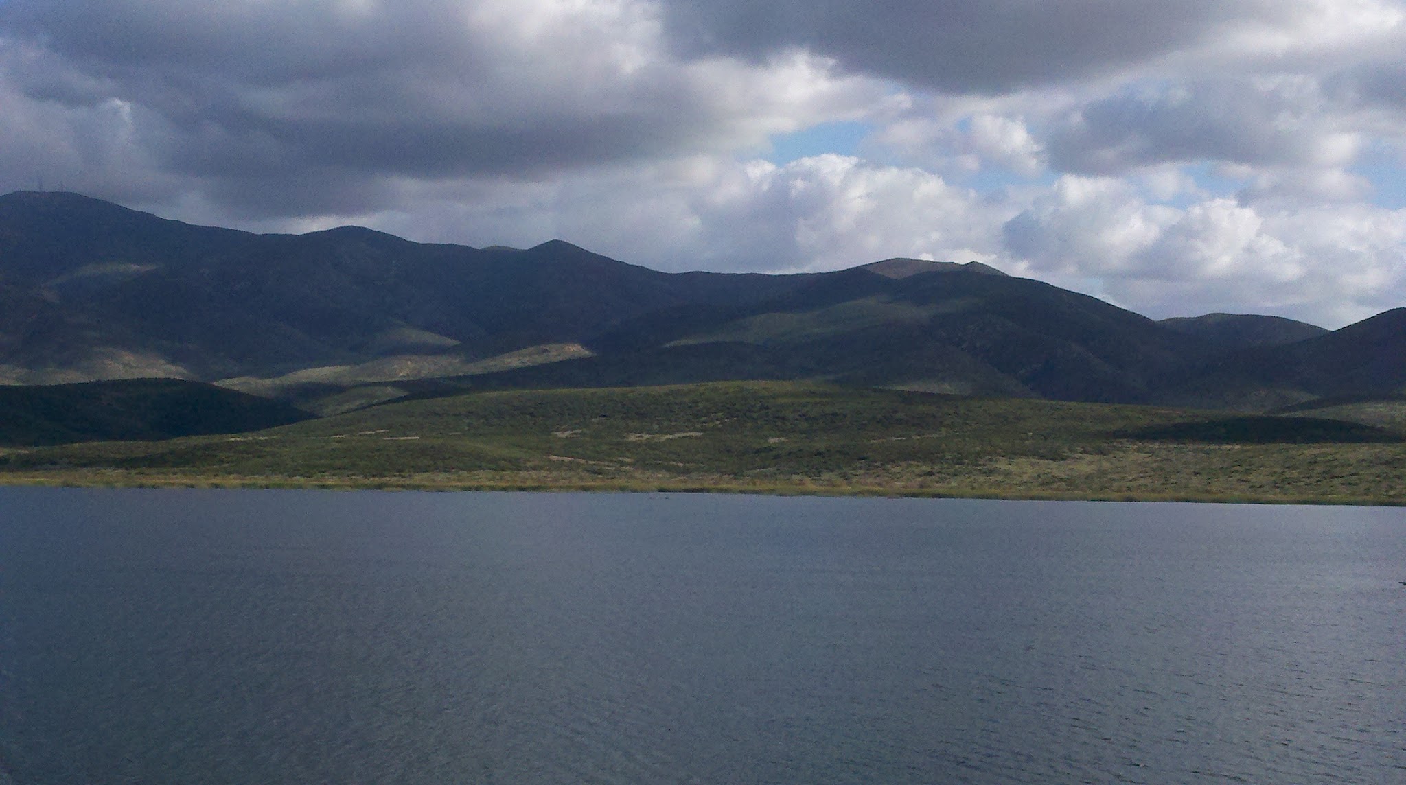
Lower Otay Reservoir
Photo Credit: Emily Perkins, SDMMP
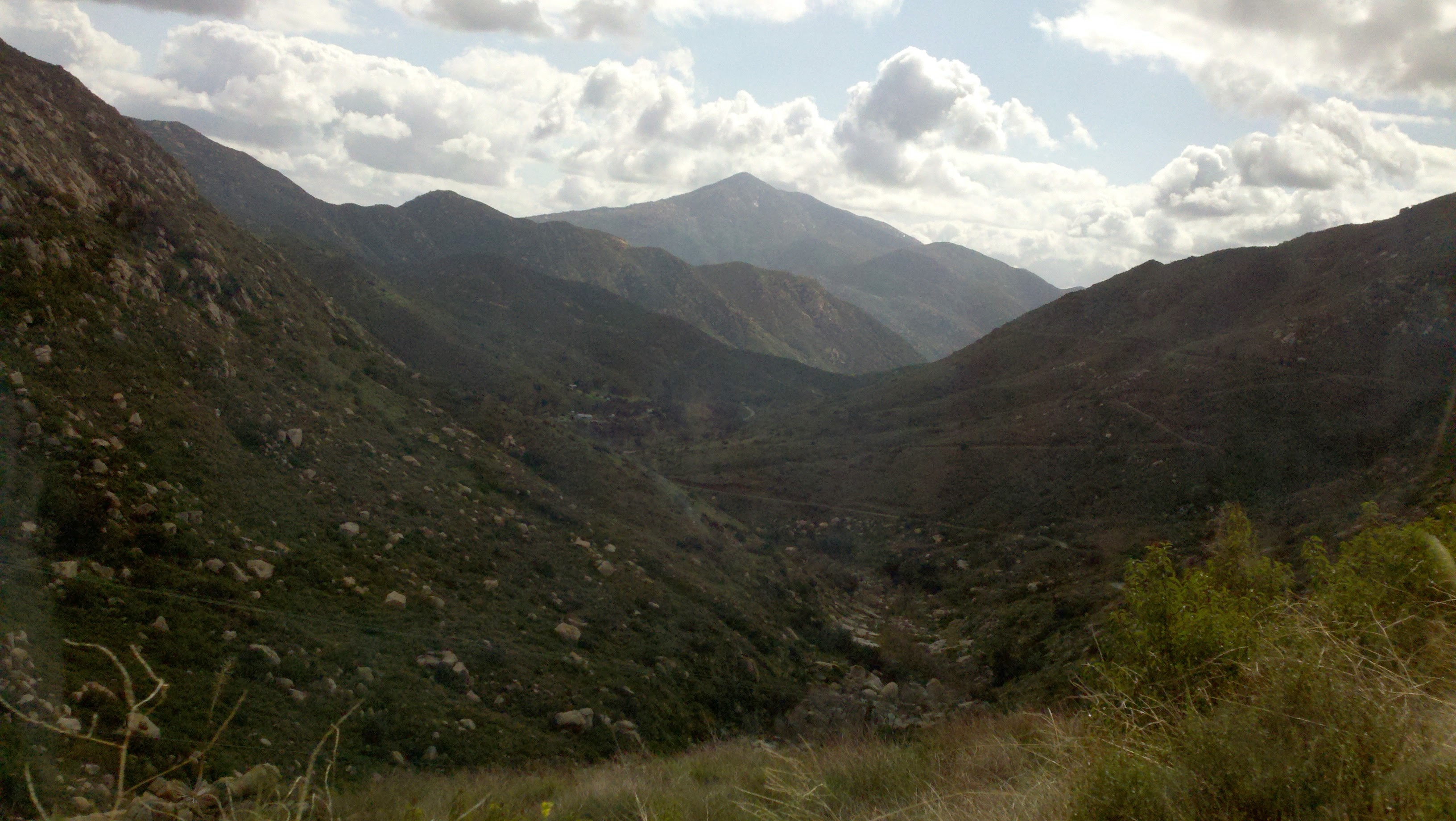
Dulzura Conduit
Photo Credit: Emily Perkins, SDMMP
Goal: Maintain, enhance and restore chaparral on Conserved Lands in the MSPA that supports or has the potential to support VF species (i.e., Del Mar manzanita, felt-leaved monardella, Lakeside ceanothus, Nuttall's scrub oak, Otay manzanita, Rainbow manzanita, wart-stemmed ceanothus, California newt, Bell's sage sparrow) and to incidentally benefit a diverse array of other species (e.g., Encinitas baccharis, Jennifer's monardella, Orcutt's hazardia, mountain lion) so that the vegetation community has high ecological integrity, and these species are resilient to environmental stochasticity, catastrophic disturbances and threats, such as very large wildfires and prolonged droughts, and will be likely to persist over the long term (>100 years).
Management units: 1, 2, 3, 4, 5, 6, 7, 8, 9, 10, 11
In 2017, prepare a long-term monitoring plan for the mosaic of chaparral, coastal sage scrub and grassland vegetation communities that focuses on tracking community composition, structure and ecological integrity over time in relation to climate (i.e., drought) and disturbance from fire. The monitoring plan should include a conceptual model, specific monitoring questions, the sampling frame within the MSPA, monitoring methods, a statistically valid sampling design, permanent sampling locations, timeline, and standardized protocols. Use the landscape-scale ecological integrity classification map to develop a sampling frame and the sampling design with permanent sampling plots spanning north to south and east to west environmental gradients across the MSPA. Evaluate how the vegetation integrity classes characterize other aspects of the ecosystem by integrating other types of monitoring into the long-term sampling plots, such as abiotic element monitoring (e.g., automated weather stations and soil sensors, GIS-data layers), ecological integrity monitoring (e.g., plant and animal communities, ecological processes), MSP VF species monitoring, and threats monitoring (e.g., fire, climate change, invasive plants). A draft monitoring plan should be prepared in 2017, tested in the field with a pilot study in 2018, and finalized by 2019.
| Action | Statement | Action status | Projects |
|---|---|---|---|
| PRP-1 | Establish a vegetation monitoring working group of scientists, wildlife agencies, land managers, and other stakeholders to participate in developing the vegetation monitoring plan. The group should also include interested parties from outside the MSPA, such as representatives from other multiple species plans in Orange and Riverside Counties and from San Diego County military bases, to create a regional monitoring program with greater efficiencies in effort and a broader inference across southern California. | In progress | |
| PRP-2 | Submit project metadata, datasets, analyses, and Chaparral, Grassland and Coastal Sage Scrub Vegetation Monitoring Plan to the MSP web portal | In progress |
| Criteria | Deadline year |
|---|---|
| Chaparral, Coastal Sage Scrub and Grassland Vegetation Monitoring Plan completed by 2019 | 2021 |
| Threat Name | Threat Code |
|---|---|
| Altered fire regime | ALTFIR |
| Climate change | CLICHN |
| Invasive plants | INVPLA |
| Loss of ecological integrity | ECOINT |
Management units: 1, 2, 3, 4, 5, 6, 7, 8, 9, 10, 11
In 2017, develop a landscape-scale map classifying ecological integrity of shrublands across the MSPA based upon shrub cover and density and invasive nonnative annual grasses using remote imagery (e.g., satellite and high resolution aerial imagery, LIDAR) and vegetation data collected during 2015-2016 California gnatcatcher regional and postfire monitoring. Verify and revise the mapping as needed using field data collected in 2018-2020 as part of the Chaparral, Coastal Sage Scrub and Grassland Vegetation Monitoring Program and from related VF species monitoring (e.g., California gnatcatcher regional and postfire monitoring). Revise the integrity classification map as needed to respond to changes in vegetation based upon wildfires, drought or other large-scale disturbances.
| Action | Statement | Action status | Projects |
|---|---|---|---|
| DEV-1 | Submit project metadata, datasets, analyses, and Ecological Integrity Classification Map to the MSP web portal | In progress | 2017-2019 Developing a Map of Ecological Integrity Using Remote Sensing, 2023-2024 Coastal sage scrub and chaparral community monitoring for western San Diego County |
| Criteria | Deadline year |
|---|---|
| Ecological Integrity Map created in 2017 and updated as needed 2018-2021 | 2021 |
| Threat Name | Threat Code |
|---|---|
| Altered fire regime | ALTFIR |
| Climate change | CLICHN |
| Invasive plants | INVPLA |
| Loss of ecological integrity | ECOINT |
Management units: 1, 2, 3, 4, 5, 6, 7, 8, 9, 10, 11
In 2018, conduct pilot monitoring to collect data and develop any recommendations for finalizing the vegetation monitoring plan. In 2019 to 2021, implement the final Chaparral, Coastal Sage Scrub and Grassland Vegetation Monitoring Plan.
| Action | Statement | Action status | Projects |
|---|---|---|---|
| IMP-1 | Submit project metadata, monitoring datasets and reports to the MSP web portal | waiting for precedent action | 2023-2024 Coastal sage scrub and chaparral community monitoring for western San Diego County |
| Criteria | Deadline year |
|---|---|
| Chaparral, Coastal Sage Scrub and Grassland Vegetation Monitoring Plan implemented 2018-2021 | 2021 |
| Threat Name | Threat Code |
|---|---|
| Altered fire regime | ALTFIR |
| Climate change | CLICHN |
| Invasive plants | INVPLA |
| Loss of ecological integrity | ECOINT |
| Metric | Condition | Trend | Confidence |
|---|---|---|---|
1. Percent ConservedPercent of baseline chaparral conserved |
Good |
Improving |
Moderate |
2. Ecological IntegrityPercent of chaparral in high integrity class based on the percent shrub cover |
Concern |
Unknown |
Moderate |
3. Fire FrequencyPercent of chaparral that has burned 2 or more times in a 30-year period |
Caution |
Declining |
Moderate |
|
2005-2007 Prioritizing and Creating Conceptual Models for MSCP Species
This project was completed for California Department of Fish and Game Local Assistance Grant #P0450009, which assessed and improved the San Diego Multiple Species Conservation Program Biological Monitoring Plan. This project was a modular effort and included critical assessments and research on 1) the implementation of the monitoring program to date and information relevant to successful monitoring program design 2) prioritization of MSCP species based on threat, 3) prioritization of ecological communities based on extent and representation, and 4) development of conceptual models to aid monitoring and management. These steps follow the monitoring program design described in Atkinson et al. 2004 which can be found at: https://sdmmp.com/view_article.php?cid=CID_jmolden%40usgs.gov_57acfadf298c1.
|
|
2008-2010 Evaluating Vegetation Data Collection Methods
The objective of this NCCP Local Assistance Grant and SANDAG EMP funded project is to evaluate different sampling designs and field protocols for monitoring coastal sage scrub (CSS) and chaparral vegetation communities. This effort addresses one of the two broad goals of the monitoring program, namely monitoring biodiversity and ecosystem function. The objective of this project is to evaluate the cost and accuracy of different sampling designs and field protocols for monitoring coastal sage scrub (CSS) and chaparral vegetation. This project builds on the Franklin, Regan and Deutschman LAG project funded by CDFG (Agreement #P0450009) and complements two other LAG grants. These projects include a review of the rare plant monitoring program for the MSCP by McEachern et al. (Agreement # P0350011) and a review of the animal monitoring portion of the MSCP by the USFWS (Agreement #P0585100). This report follows and elaborates on ideas presented in two earlier reports submitted to CA DFG (Deutschman, Franklin, and Lewison - Agreement # P0685105; Deutschman - Agreement # P0782006).
|
|
2008-2011 Evaluating Remote Sensing Methods for Vegetation Monitoring
Identifying habitats that should be protected from further disturbance or conversion and isolating high-risk areas is a focus of community habitat plans in southern California shrublands. Larger wildfires are occurring at shorter intervals in recent decades, contributing to degradation and conversion of shrubland vegetation. Multitemporal remote-sensing approaches can bridge the gap between vegetation mapping and field sampling in habitats where frequent quantification and mapping of vegetation growth forms over large extents is required. The objective of this study is to examine the reliability and stability of a multiple endmember spectral mixture analysis (MESMA) approach with moderate spatial resolution imagery for monitoring changes in growth form fractional cover in shrubland habitats. Estimates from visual interpretation of high spatial resolution image were used as reference data for validating MESMA-derived maps and as basis for providing complementary monitoring protocols that may be accurate and cost-effective across multiple scales. Growth form proportions modelled in burned and unburned management areas compare well with expected fractional cover in mature and regenerating shrublands. In themanagement areas recovering from fire, herbaceous cover fraction exceeded 0.40 for all three study dates, suggesting that large portions of those management areas may already be invaded. From 2008 to 2011 overall herbaceous cover fraction in shrubland area increased by 2%. Herbaceous cover fraction was modelled with an overall mean absolute error (MAE) of 0.08, a smaller percentage than the percentage of herbaceous cover change recorded in areas recovering from fire (increase in herbaceous cover fraction from 0.09 to 0.13). This MESMA approach would be effective for quantifying changes in fractional cover that exceed 0.10, providing a way to delineate and quantify herbaceous invasions and expansions following disturbance or succession.
|
|
2010-2012 Refining Research Objectives and Data Collection Methods
A new phase of the vegetation monitoring program began in 2010. After several years focused on data collection and analysis, this project focused on closing the feedback loop as envisioned in Atkinson et al. 2004. Work involved a wide array of stakeholders to revise and update the goals and objectives of the monitoring and management plans, develop conceptual models for individual preserves, and adapt and apply management plans on individual preserves. One aspect of this work was a structured workshop. The workshop, based on the Dahlem model, was the first concrete step in facilitating collaborative decision making.
|
|
2017-2019 Developing a Map of Ecological Integrity Using Remote Sensing
This project's objective is to create a map of ecological integrity using remotely sensed data. Data sources include high resolution lidar and high resolution 4-band imagery from multiple sources. Final products from this work will include: 1) an updated high resolution Digital Elevation Model, 2) an updated high resolution Digital Surface Model, 3) a raster image depicting vegetation height (using lidar), 4) a raster image depicting herbaceous, shrub, and tree cover, 5) a map layer of ecological integrity (at a 50m grid) for coastal sage scrub, chaparral, oak woodlands, and riparian woodlands. Ecological integrity is defined for each vegetation community independently, based on analysis of previous field work. This project will build off the information and products previously created.
|
|
2023-2024 Coastal sage scrub and chaparral community monitoring for western San Diego County
Western San Diego County is dominated by shrublands supporting biologically diverse native plant and animal communities. Widespread urbanization has led to regional habitat loss and fragmentation and many species in these shrubland communities are rare, threatened, or endangered. Large-scale, multiple species conservation planning has resulted in a regional preserve system that focuses on these shrubland communities. A number of large-scale threats are leading to type conversion from shrub-dominated to non-native invasive annual grass-dominated vegetation. To understand the changes that are occurring to native shrublands, we have developed a vegetation monitoring program with several components at multiple spatial scales, focused on quantifying coastal sage scrub (CSS) and chaparral vegetation community characteristics. Several drivers of change associated with type conversion of native shrubland to non-native annual grassland have been identified by previous research including increasing fire frequency, nitrogen deposition from air pollution, and prolonged and intense drought associated with changing climate.
The objectives of this CSS and chaparral vegetation community monitoring plan are to:
1) Determine the distribution, composition, structure, and integrity of CSS and chaparral vegetation communities on conserved lands in western San Diego County,
2) Identify whether these attributes of the vegetation communities are changing over time, and
3) Evaluate relationships of known drivers of change (threats) and environmental factors in association with changes in vegetation community attributes.
The goal of this monitoring program is to classify CSS and chaparral vegetation community integrity, identify areas of degradation across western San Diego County, and characterize drivers, and environmental factors associated with loss of ecological integrity. A combination of vegetation mapping, landscape-scale remote sensing, and field plots will be used to address all the aspects of our research questions. Data compiled and collected will be available to conservation partners to help inform future management decisions.
|
|
American Badger Research and Monitoring
Badgers have been identified by the San Diego Monitoring and Management Program Connectivity Monitoring Strategic Plan as a target species for monitoring regional-scale functional connectivity of upland and grassland habitats. However, prior to these studies there was little information on badger distribution, movement, or habitat use within San Diego County. In 2011, the California Department of Fish and Game Local Assistance Grant funded an initial study to determine if badgers still persist in the western portion of San Diego County. Canine scent surveys were conducted for American badger scat from November 14-December 14, 2011. Thirty-two sites in San Diego County and two sites in southern Riverside County were surveyed. The scent dog had positive behavioral responses to scat at 13 sites, and a badger specific DNA test verified the scat collected at twelve sites. A recommendation from the 2011 study led researchers to develop a microsatellite DNA test to identify individual animals from scat. This would allow for estimation of minimum population sizes in areas with multiple scats. In 2014, a follow up study was conducted to the initial 2011 rapid assessment for the American badger. The objectives were to identify target areas with potentially higher densities of badgers and to better assess the level of connectivity between known occupied areas. Thirty canine scent surveys for badger scat were conducted. This study involved: 1) additional focused surveys to identify areas occupied by badgers, and 2) determination of the number of badgers at various locations using genetic tests of scat or hair to identify individuals. In 2015, researchers continued studies of the spatial and temporal use of habitats by the American badger by conducting monthly field sign and infrared camera surveys across seven focal sites in the County where we previously documented substantial and/or repeated badger activity. The objective was to determine if badger use is irregular, seasonal, or consistent. American badgers were active at two of the seven focal sites in 2015, the upper San Diego River at El Capitan Grande Reservation and Rancho Guejito. From 2011 to present, researchers established that the American badger currently occupies or uses conserved lands within MSCP and MHCP and many other portions of the county.
|
|
Blaineville's Horned Lizard Genetics Study
The proposed study will provide data on whether coast horned lizard populations are genetically interconnected across the NCCP reserve system, or whether gene flow has occurred recently but is no longer possible due to habitat fragmentation.
|
|
Dehesa Nolina Conservation and Management Strategy
The Conservation Biology Institute developed a science-based Conservation Vision and
Management Strategy for Dehesa nolina in San Diego County. The Conservation Vision
assessed the distribution, status, and threats of populations on conserved lands through data and
literature reviews, site visits, and interviews with land managers. Products included spatial data
layers, an updated matrix of threats and stressors, management recommendations, and prioritized
populations for management.
The Management Strategy focused on preserve-level management, using the existing Dehesa
nolina population on the South Crest Preserve to test/refine management techniques, including
species augmentation (seed collection, contract growing of plants, out-planting) and erosion
control. These actions also benefitted Dudleya variegata (variegated dudleya) and sensitive
native grassland habitat. These management actions complemented other Transnet-funded
management on South Crest; techniques refined in this project are applicable to other conserved
populations in the region. Project partially funded by SANDAG TransNet EMP Land Management Grant #5001763
|
|
Enhancing the Resilience of Edaphic Endemic Plants
The Management Strategic Plan for San Diego County requires prioritization and management for edaphic endemic plants, including the five rare plants addressed in this study. These species face low genetic diversity due to reduced population sizes, geographic isolation, and loss of pollinators. To enhance the resilience of these species across their ranges, we must manage threats to increase population sizes, identify potentially suitable habitat to connect existing populations, find or restore new populations, and provide opportunities for shifting distributions due to climate change.
This study identifies and describes geographic areas that support the five edaphic endemic species and their habitat in a design that enhances resilience and provides opportunities for shifting distributions. We developed conceptual models to inform field studies and management, refined soils and vegetation attributes, and assessed regional population structure and threats. We used results to suggest prioritized locations for surveys, management, potential translocation, and additional conservation or acquisition. Project partners (U.S. Geological Survey and San Diego Management and Monitoring Program) modeled suitable habitat for the target species under current and future climate scenarios; we reference models as appropriate.
|
|
Invasive Plant Control - Silverwood Wildlife Sanctuary
Silverwood Wildlife Sanctuary, owned and operated by San Diego Audubon since 1966, is maintained to preserve 787 acres of prime coastal chaparral and riparian woodland habitat in San Diego County, consistent with objectives described in the Management Strategic Plan (MSP). Like much of San Diego County, sensitive wildlife in the preserve is threatened by the presence and potential spread of invasive non-native plant species. This project supports the implementation of invasive plant control in priority habitat areas within the preserve. The primary goal is to reduce extant populations of invasive species and prevent their further spread. Project objectives include treatment of approximately 65 acres of invasive species hot spots with herbicide and approximately 5 acres of emergent invasive species treated via hand management, reducing invasive cover by 90% within the 18-month grant term. This funding is a priority and imminent need for the preserve, largely due to drought-caused, elevated instances of invasive species that threaten high-quality habitat.
|
|
Pollinator Monitoring Plan
Declines of insects are being reported worldwide and includes several pollinator species in California. With reduced abundances and loss of species, there is a possibility that the ecosystem function of pollination is being compromised. The most common pollinators are Hymenoptera (bees and wasps), Coleoptera (beetles), Diptera (flies), and Lepidoptera (butterflies and moths). Overall, about 87 percent of plant species are pollinated by insects. San Diego Association of Governments TransNet Environmental Mitigation Program's Regional Management and Monitoring 2021-2022 and 2023-2024 workplans include objectives to improve wildlife movement. These objectives are based on the San Diego Management and Monitoring Program's Management and Monitoring Strategic Plan for Conserved Lands in Western San Diego County (MSP Roadmap; SDMMP and TNC 2017). Objectives for 2022-2026 are to prepare and implement a monitoring plan to survey pollinator communities and assess ecological integrity of pollinator functions in coastal sage scrub, chaparral, forblands and grasslands across the MSP Area. This project will prepare pollinator data in 2021 for analysis in 2022 and development of a pollinator monitoring pilot study plan in 2023 to be implemented in 2024. This plan is being prepared in conjunction with a coastal sage scrub, chaparral, and grassland vegetation monitoring plan. Pollinator sampling locations will be co-located at vegetation sampling plots.
|
|
Post-Fire Monitoring - Herpetofauna sampling
This study involves sampling herpetofauna at 65 pitfall arrays during two summer sample periods at each of the four pitfall trapping study sites.
|
|
Post-Fire Monitoring - Terrestrial Biodiversity Vegetation Transects
This task involves conducting one round of standardized vegetation transects at each of the 65 pitfall arrays divided among the four study sites.
|
|
Post-Fire Monitoring -Small Mammal Sampling
This study involves sampling small mammals at pitfall arrays during four sample periods at each of the four pitfall trapping study sites that were sampled after the 2003 wildfires. Macro-invertebrate and ant samples were to be collected.
|
|
Rare Plant Inspect and Manage Monitoring 2014-2026
From 2014-2026, a Management and Monitoring Strategic Plan (MSP Roadmap) monitoring objective for 30 rare plant species is to inspect occurrences to determine management needs. The inspect and manage (IMG) objective is implemented to document the status of rare plant occurrences and assess habitats and threats to develop specific management recommendations. IMG monitoring is implemented by a combination of land managers and contracted biologists in coordination with the SDMMP. Available rare plant data is posted below. New annual updates are typically posted in March. Based upon an evaluation of these data, a 2014-2026 monitoring schedule has been developed for the 30 rare plant species (attached below). Coordinating data collection across the region allows analyses of species and population trends over time and provides a better understanding of the association between habitat and threat covariates and population dynamics.
|
|
Reserve Connectivity for Focal Species: American Badger
An assessment of which areas within and adjacent to the San Diego Multiple Species Conservation Program (MSCP) are occupied by American badger and would be suitable for further study of connectivity for badger. The Connectivity Monitoring Strategic Plan (CMSP) lists badgers as a priority for functional connectivity monitoring. The objective of this study was to identify badger locations in San Diego using canine scent detection. This method is advantageous in that large areas can be surveyed, in relatively little time, for badger scat, yielding information on badger home range locations and habitat usage within the county. This information will be utilized in future years to implement subsequent portions of the CMSP priority 1 connectivity monitoring of badgers which will analyze badger movement using radio telemetry techniques.
|
|
San Dieguito Citizen Science Monitoring Program
The San Dieguito River Valley Conservancy (SDRVC) developed the San Dieguito Citizen Science Monitoring Program as a sustainable, cost-effective, and scientifically valid approach to gather critical data on lands within the San Dieguito River Park Focused Planning Area. This program seeks to fill knowledge gaps on the diversity, population, movements and spatial ecology of species within the watershed to better inform future land acquisitions, adaptive land management, habitat and species restoration, educational initiatives and future research. One of the main objectives of this program is to gather data that is consistent and shared with other regional planning efforts being coordinated by the San Diego Management & Monitoring Program. Data collected is submitted to regional databases and will help meet the management goals and objectives identified in the Management & Monitoring Strategic Plan. Annual expert-led surveys are carried out by volunteer citizen scientists following approved protocols and encourage community involvement and engagement.
|
|
Vegetation Mapping 2026
The goal of this project is to create a new vegetation map for the western portion of San Diego County. This will be based on the Vegetation Classification Manual hierarchical classification system. The map will consist of a group-level comprehensive map based on satellite remote sensing and an alliance/association map focused on existing preserves or important resources.
|
|
Vegetation Mapping and Classification 2012
This project first created a vegetation classification system and manual. Then, based on 2012 data, this project completed 3 tasks: Task 1. Vegetation Mapping. Task 2. Invasive Nonnative Species Plant Mapping. Task 3. Tecate Cypress Mapping. In 2014, the data was updated based on user's comments. The final products are available to download in the data section.
|
|
Veldt Grass Removal - San Elijo Lagoon Ecological Reserve
The San Elijo Lagoon Conservancy (SELC) aims to secure funding to begin Phase I of eradicating perennial veldt grass (Ehrharta calycha) in the San Elijo Lagoon Ecological Reserve (Reserve). The invasive nonnative grass species currently occurs in Diegan coastal sage scrub, southern maritime chaparral, and riparian scrub habitats. It is also capable of invading coastal dune habitats, potentially displacing several high priority Management Strategic Plan (MSP) plant and animal species. SELC proposes to treat the current range of perennial veldt grass in the reserve and continue to monitor the spread or lack thereof. Perennial veldt grass ls currently under SMSP management level 3 for invasive non-native plants, and needs further evaluation and management information. The proposed project will provide crucial information regarding the species and the potential for its control and eradication.
|
Chaparral is comprised of evergreen drought-and fire-tolerant shrubs with sclerophyllus leaves [1] adapted to long, hot, dry summers and intermittent rain in winter. The MSP focus is on chaparral communities in the western part of San Diego County in the foothills, but not the mountains. Includes southern mixed chaparral, northern mixed chaparral, chamise chaparral, scrub oak chaparral, southern maritime chaparral, and the coastal sage-chaparral transition [2]. Southern mixed chaparral is part of the upper Sonoran mixed chaparral community of shrubs that are 1.5-3 m tall [2], with occasional patches of bare soil or a mosaic with sage scrub. Dominant plants in San Diego include Ceanothus spp., especially C. tomentosus var. olivaceus, as well as C. leucodermis and C. oliganthus. Granitic and mafic southern mixed chaparral are two different subtypes based on substrate. Northern mixed chaparral is part of the upper Sonoran mixed chaparral community of shrubs 2-4 m tall [2] with dense and nearly impenetrable vegetation, dominated by Quercus berberidifolia, Adenostoma fasciculatum, Arctostaphylos spp., and Ceanothus spp. Plants are typically deep rooted, usually with little or no understory vegetation, and often a considerable accumulation of leaf litter. Growth is highest in the spring and greatly reduced in winter at higher elevations. Flowering occurs from later winter to early summer. Chamise chaparral is dominated by 1-3 m tall A. fasciculatum. Mature sites are dense with very little herbaceous understory or litter. Scrub oak chaparral is a dense, evergreen chaparral up to 6 meters tall [2] dominated by Q. berberidifolia in San Diego County with over 50% cover. Usually occurs in small patches within a variety of other vegetation communities. Southern maritime chaparral, sometimes referred to as coastal mixed chaparral, is a low and fairly open chaparral found in the coastal fog belt. It is dominated by C. verrucosus and Arctostaphylos glandulosa ssp. crassifolia [2]. The coastal sage-chaparral transition community is a mix of sclerophyllous , woody chaparral species, and drought-deciduous, malacophyllous sage scrub species. A. fasciculatum and Artemesia californica are the codominant species [2].
There are 15 chaparral alliances in the MSPA [4]. The southern mixed chaparral community includes some of the most abundant chaparral alliances: A. fasciculatum-Xylococcus bicolor, Arctostaphylos glandulosa, and Cenothus tomentosus. The chamise chaparral community with the A. fasciculatum alliance is second most abundant, followed by the scrub oak chaparral community with the Quercus berberidifolia x acutidens and Q. berberidifolia x acutidens-A. fasciculatum alliances.
Southern mixed chaparral is found in coastal foothills of San Diego County and northern Baja California, usually below 910 m [2]. Northern mixed chaparral occurs more inland [1] and is found on Transverse and Peninsular Ranges of southern California on slopes away from the desert, usually below 1520 m. Chamise chaparral distribution is similar to northern mixed chaparral [2]. Scrub oak chaparral is found from western Sierran foothills and North Coast ranges to Baja California. Most often found in San Diego County on the Cleveland National Forest, ridges on the east end of Henshaw Valley, and in McCain Valley [2]. Southern maritime chaparral is restricted in San Diego County to coastal areas such as Torrey Pines State Reserve, along the San Dieguito River Valley, Rancho Santa Fe, and a few other scattered locations [2]. The coastal sage-chaparral transition community occurs along outer Coast Ranges and Peninsular Range from the Big Sur Coast south to Baja [2].
There are 709,024 acres of chaparral in the MSPA in all MUs, of which, 406,270 acres are conserved. The more inland MUs (9, 10 and 11) support 444,140 acres of chaparral with 282,191 acres (64%) conserved. MUs 3, 4, 5, and 8 have 108,169 acres (47%) conserved of the 228,806 acres of chaparral.
Southern mixed chaparral occurs on dry, rocky, and often steep north-facing slopes with little soil and moderate temperature [2]. Granitic southern mixed chaparral occurs on granitic soils while mafic southern mixed chaparral occurs on mafic or metavolcanic soils. Northern mixed chaparral is found on dry, rocky, and often steep north-facing slopes with minimal soil [2]. Often adjacent to and on rockier sites than oak woodland and grasslands; rockier but moister sites than coastal sage scrub; and warmer, rockier, and drier sites than broadleaved evergreen forest or lower montane coniferous forest. Chamise chaparral has similar site preference to southern and northern mixed chaparral, but on shallower, drier soils, and at lower elevations [2] and is often found on xeric slopes and ridges. Scrub oak chaparral sites are somewhat more mesic than other chaparral sites and often occur at higher elevations up to 1,525 m with substantial accumulations of leaf litter. In San Diego, elevation can vary and sites are typically north facing or with mesic slopes. Southern maritime chaparral occurs in weathered sands within the coastal fog belt [2]. The coastal sage-chaparral transition community is an intermediate between coastal scrub and chaparral communities [2].
Northern mixed chaparral is adapted to repeated fires with many species responding by stump sprouting [2]. A dense cover of annual herbs is common the first growing season after a fire, followed in subsequent years by perennial herbs, short-lived shrubs, and the reestablishment of original dominant shrub species. Chamise chaparral is also adapted to repeat fires by stump resprouting [2]. Scrub oak chaparral often recovers from fire faster than other chaparrals due to the favorable mesic soils [2]. Fire appears necessary in southern maritime chaparral for continued reproduction of many characteristic species. The coastal sage-chaparral transition is usually a post-fire successional community.
Short fire return interval (5-10 yrs) have lead to type conversion from chaparral and coastal sage scrub to non-native annual grasslands [5, 6]. Urban development threatens chaparral through habitat loss and alteration [7]. Due to climate change, the climate in California is projected to become warmer and drier with more frequent, intense and prolonged drought [8]. Extensive chaparral shrub mortality has been attributed to intense and prolonged droughts [9, 10]. A changing regional climate is attributed to an upward shift in the distribution of chaparral species in the Santa Rosa Mountains of southern California [9]
Chaparral communities in the MSPA support 50 MSP species (see Vol2C Section 2 for full list).
[1] Quinn, R. D., and S. C. Keeley. 2006. Introduction to California Chaparral. Berkeley, CA: University of California Press.
[2] Oberbauer, T. A., M. Kelly, and Jeremy Buegge. 2008. Draft Vegetation Communitties of San Diego County. Based on “Preliminary Descriptions of the Terrestrial Natural Communities of Californiaâ€, Robert F. Holland, Ph.D., October 1986. San Diego, CA.
[3] Sproul, F., Keeler-Wolf, T., Gordon-Reedy, P., Dunn, J., Klein, A., & Harper, K. (2011). Vegetation Classification Manual for Western San Diego County (First). San Diego, CA."
[4] Oberbauer, T., F. Sproul, J. Dunn, and L. Wolley. 2012. ECO_VEGETATION_WSD. Prepared by AECOM, California Department of Fish and Wildlife Published by AECOM and SANDAG Technical Services. www.sangis.org. Accessed September 2016.
[5] Minnich, R. A. and R. J. Dezzani. 1998. Historical decline of coastal sage scrub in the Riverside-Perris Plain, California. Western Birds 29:366-391.
[6] Keeley, J. E. and T. J. Brennan. 2012. Fire-driven alien invasion in a fire-adapted ecosystem. Oecologia 169:1043-1052.
[7] Sauvajot, R. M., M. Buechner, D. A. Kamradt, and C. M. Schonewald. 1998.Patterns of Human Disturbance and Response by Small Mammals and Birds in Chaparral Near Urban Development. Urban Ecosystems 2: 279–97. doi:10.1023/A:1009588723665.
[8] Diffenbaugh, N. S., D. L. Swain, and D. Touma. 2015. Anthropogenic Warming has Increased Drought Risk in California. Proceedings of the National Academy of Sciences 112:3931-3936.
[9] Kelly, A. E. and M. L. Goulden. 2008. Rapid Shifts in Plant Distribution with Recent Climate Change. Proceedings of the National Academy of Sciences 105:11823-11826.
[10] Keeley, J. E., H. Safford, C. J. Fotheringham, J. Franklin, and M. Moritz. 2009. The 2007 southern California wildfires: Lessons in complexity. Journal of Forestry XX:287-296.