Basic Information
Vegetation Community: Grassland
Community Code: GRASSL
Vegetation Community Map
Loading...

Species Information

MSP Species Background

Goals and Objectives

Goal: Enhance and restore native grasslands and forblands and manage nonnative grasslands on Conserved Lands in the MSPA that support or have the potential to support VF species (i.e., grasshopper sparrow and San Diego black-tailed jackrabbit) and to incidentally benefit a diverse array of other species (e.g., Quino checkerspot, burrowing owl, golden eagle, Stephen's kangaroo rat) so that the vegetation communities have high ecological integrity, and these species are resilient to environmental stochasticity and will be likely to persist over the long term (>100 years).

Regional NFO 2017, 2018, 2019
MON-PRP-MONPL GRASSL-1

Management units: 1, 2, 3, 4, 5, 6, 7, 8, 9, 10, 11

In 2017, prepare a long-term monitoring plan for the mosaic of chaparral, coastal sage scrub and grassland vegetation communities that focuses on tracking community composition, structure and ecological integrity over time in relation to climate (i.e., drought) and disturbance from fire. The monitoring plan should include a conceptual model, specific monitoring questions, the sampling frame within the MSPA, monitoring methods, a statistically valid sampling design, permanent sampling locations, timeline, and standardized protocols. Use the landscape-scale ecological integrity classification map to develop a sampling frame and the sampling design with permanent sampling plots spanning north to south and east to west environmental gradients across the MSPA. Evaluate how the vegetation integrity classes characterize other aspects of the ecosystem by integrating other types of monitoring into the long-term sampling plots, such as abiotic element monitoring (e.g., automated weather stations and soil sensors, GIS-data layers), ecological integrity monitoring (e.g., plant and animal communities, ecological processes), MSP VF species monitoring, and threats monitoring (e.g., fire, climate change, invasive plants). A draft monitoring plan should be prepared in 2017, tested in the field with a pilot study in 2018, and finalized by 2019.

Action Statement Action status Projects
PRP-1 Establish a vegetation monitoring working group of scientists, wildlife agencies, land managers, and other stakeholders to participate in developing the vegetation monitoring plan. The group should also include interested parties from outside the MSPA, such as representatives from other multiple species plans in Orange and Riverside Counties and from San Diego County military bases, to create a regional monitoring program with greater efficiencies in effort and a broader inference across southern California. In progress
PRP-2 Submit project metadata, datasets, analyses, and Chaparral, Coastal Sage Scrub, and Grassland Monitoring Plan to the MSP web portal In progress
Criteria Deadline year
Chaparral, Coastal Sage Scrub and Grassland Vegetation Monitoring Plan completed by 2019 2021
Threat Name Threat Code
Altered fire regimeALTFIR
Climate changeCLICHN
Invasive plantsINVPLA
Loss of ecological integrityECOINT
Code Obj. code Statement
COSASC-2 MON-DEV-MAP In 2017, develop a landscape-scale map classifying ecological integrity of shrublands across the MSPA based upon shrub cover and density and invasive nonnative annual grasses using remote imagery (e.g., satellite and high resolution aerial imagery, LIDAR) and vegetation data collected during 2015-2016 California gnatcatcher regional and postfire monitoring. Verify and revise the mapping as needed using field data collected in 2018-2020 as part of the Chaparral, Coastal Sage Scrub and Grassland Monitoring Program and from related VF species monitoring (e.g., California gnatcatcher regional and postfire monitoring). Revise the integrity classification map as needed to respond to changes in vegetation based upon wildfires, drought or other large-scale disturbances.
COSASC-3 MON-IMP-MONPL In 2018, conduct pilot monitoring to collect data and develop any recommendations for finalizing the monitoring plan. From 2019 to 2021, implement the final Chaparral, Coastal Sage Scrub and Grassland Vegetation Monitoring Plan.
Regional NFO 2017, 2018, 2019, 2020, 2021
MON-DEV-MAP GRASSL-2

Management units: 1, 2, 3, 4, 5, 6, 7, 8, 9, 10, 11

In 2017, develop a landscape-scale map classifying ecological integrity of shrublands across the MSPA based upon shrub cover and density and invasive nonnative annual grasses using remote imagery (e.g., satellite and high resolution aerial imagery, LIDAR) and vegetation data collected during 2015-2016 California gnatcatcher regional and postfire monitoring. Verify and revise the mapping as needed using field data collected in 2018-2020 as part of the Chaparral, Coastal Sage Scrub and Grassland Monitoring Program and from related VF species monitoring (e.g., California gnatcatcher regional and postfire monitoring). Revise the integrity classification map as needed to respond to changes in vegetation based upon wildfires, drought or other large-scale disturbances.

Action Statement Action status Projects
DEV-1 Submit project metadata, datasets, analyses, and Ecological Integrity Classification Map to the MSP web portal In progress 2017-2019 Developing a Map of Ecological Integrity Using Remote Sensing
Criteria Deadline year
Ecological Integrity Map created in 2017 and updated as needed 2018-2021 2021
Threat Name Threat Code
Altered fire regimeALTFIR
Climate changeCLICHN
Invasive plantsINVPLA
Loss of ecological integrityECOINT
Code Obj. code Statement
COSASC-1 MON-PRP-MONPL In 2017, prepare a long-term monitoring plan for the mosaic of chaparral, coastal sage scrub and grassland vegetation communities that focuses on tracking community composition, structure and ecological integrity over time in relation to climate (i.e., drought) and disturbance from fire. The monitoring plan should include a conceptual model, specific monitoring questions, the sampling frame within the MSPA, monitoring methods, a statistically valid sampling design, permanent sampling locations, timeline, and standardized protocols. Use the landscape-scale ecological integrity classification map to develop a sampling frame and the sampling design with permanent sampling plots spanning north to south and east to west environmental gradients across the MSPA. Evaluate how the vegetation integrity classes characterize other aspects of the ecosystem by integrating other types of monitoring into the long-term sampling plots, such as abiotic element monitoring (e.g., automated weather stations and soil sensors, GIS-data layers), ecological integrity monitoring (e.g., plant and animal communities, ecological processes), MSP VF species monitoring, and threats monitoring (e.g., fire, climate change, invasive plants). A draft monitoring plan should be prepared in 2017, tested in the field with a pilot study in 2018, and finalized by 2019.
COSASC-3 MON-IMP-MONPL In 2018, conduct pilot monitoring to collect data and develop any recommendations for finalizing the monitoring plan. From 2019 to 2021, implement the final Chaparral, Coastal Sage Scrub and Grassland Vegetation Monitoring Plan.
POLPOL-1 MON-IMP-MONPL In 2020, implement regional and subregional California gnatcatcher monitoring initiated in 2016 to determine the percent area occupied (PAO) by California gnatcatcher in modeled high and very high suitability habitat on Conserved Lands and military lands in the MSPA as part of a larger monitoring program for southern California. Over the next 15 years, determine trends in California gnatcatcher PAO and in their colonization and extinction rates and be able to detect at least 30% change in PAO. Identify associations between habitat and threat correlates with gnatcatcher PAO and with extinction and colonization rates and develop biologically meaningful thresholds for management and to specify management criteria and recommendations.
POLPOL-2 MON-RES-SPEC In 2020, implement California gnatcatcher postfire monitoring conducted in 2015 and 2015 to: determine whether there has been further recovery of California gnatcatchers in areas burned in 2003, 2007 and 2014 (i.e., PAO>10%); evaluate if there is a difference in PAO between areas burned in 2003, 2007 and 2014; investigate the relationship between gnatcatcher PAO and vegetation composition, cover and structure; and evaluate the composition, cover and structure of coastal sage scrub in areas with different fire frequencies and patterns of vegetation recovery based upon time since fire, spatial distribution, previous land use, and environmental conditions. Use the regional gnatcatcher and vegetation monitoring protocols to monitor postfire recovery of gnatcatchers and vegetation at sampling points surveyed in 2016. Analyze gnatcatcher and vegetation data to develop overall and site specific vegetation management recommendations for postfire recovery of coastal sage scrub vegetation to support California gnatcatchers.
Regional NFO 2018, 2019, 2020, 2021
MON-IMP-MONPL GRASSL-3

Management units: 1, 2, 3, 4, 5, 6, 7, 8, 9, 10, 11

In 2018, conduct pilot monitoring to collect data and develop any recommendations for finalizing the monitoring plan. From 2019 to 2021, implement the final Chaparral, Coastal Sage Scrub and Grassland Vegetation monitoring plan.

Action Statement Action status Projects
IMP-1 Submit project metadata, monitoring datasets and reports to the MSP web portal waiting for precedent action
Criteria Deadline year
Chaparral, Coastal Sage Scrub and Grassland Vegetation Monitoring Plan implemented 2018-2021 2021
Threat Name Threat Code
Altered fire regimeALTFIR
Climate changeCLICHN
Invasive plantsINVPLA
Loss of ecological integrityECOINT
Code Obj. code Statement
COSASC-1 MON-PRP-MONPL In 2017, prepare a long-term monitoring plan for the mosaic of chaparral, coastal sage scrub and grassland vegetation communities that focuses on tracking community composition, structure and ecological integrity over time in relation to climate (i.e., drought) and disturbance from fire. The monitoring plan should include a conceptual model, specific monitoring questions, the sampling frame within the MSPA, monitoring methods, a statistically valid sampling design, permanent sampling locations, timeline, and standardized protocols. Use the landscape-scale ecological integrity classification map to develop a sampling frame and the sampling design with permanent sampling plots spanning north to south and east to west environmental gradients across the MSPA. Evaluate how the vegetation integrity classes characterize other aspects of the ecosystem by integrating other types of monitoring into the long-term sampling plots, such as abiotic element monitoring (e.g., automated weather stations and soil sensors, GIS-data layers), ecological integrity monitoring (e.g., plant and animal communities, ecological processes), MSP VF species monitoring, and threats monitoring (e.g., fire, climate change, invasive plants). A draft monitoring plan should be prepared in 2017, tested in the field with a pilot study in 2018, and finalized by 2019.
COSASC-2 MON-DEV-MAP In 2017, develop a landscape-scale map classifying ecological integrity of shrublands across the MSPA based upon shrub cover and density and invasive nonnative annual grasses using remote imagery (e.g., satellite and high resolution aerial imagery, LIDAR) and vegetation data collected during 2015-2016 California gnatcatcher regional and postfire monitoring. Verify and revise the mapping as needed using field data collected in 2018-2020 as part of the Chaparral, Coastal Sage Scrub and Grassland Monitoring Program and from related VF species monitoring (e.g., California gnatcatcher regional and postfire monitoring). Revise the integrity classification map as needed to respond to changes in vegetation based upon wildfires, drought or other large-scale disturbances.
regional NFO 2019, 2020
MGT-PRP-BMPPL GRASSL-4

Management units: 3, 4, 5, 6, 8, 9, 10, 11

Beginning on 2019, prepare a plan to test the use of grazing, prescribed fire and other methods of landscape-scale control of invasive grasses and forbs in grassland and coastal sage scrub vegetation communities as BMPs to promote MSP species, native plants and animals, and natural ecosystem processes. The plan should determine the effects of different techniques on natural resources at less than 200 acre treatment areas at 3 different sites in the MSPA. Development of the study plan's experimental approach should include a review of the literature on the effects of grazing, prescribed fire, and other methods of invasive plant control on coastal sage scrub and grassland ecosystems to develop a conceptual model for management and monitoring. The plan should detail how to test different plant control methods over at least 3 years and should include the specific monitoring questions, objectives, and monitoring targets, a statistically valid experimental design with monitoring methods, sampling locations, and standardized protocols. The plan should include annual monitoring to determine the benefits and impacts of each method on natural resources and to track financial costs, logistics and sustainability of invasive plant control.

Action Statement Action status Projects
PRP-2 Work with land managers, wildlife agencies, and scientists to determine: methods of landscape-scale invasive plant control to test in coastal sage scrub and grassland ecosystems; locations for testing methods; monitoring targets including MSP species, native plant and animal taxa, and ecological processes; and review of results and development of long-term management and monitoring methods. See COSASC-5 and GRASSL-5 actions for additional information to include in the plan. on hold
Criteria Deadline year
Plan to Test Landscape-scale Invasive Plant Control of Coastal Sage Scrub and Grassland Ecosystems Completed in 2020 2021
Threat Name Threat Code
Altered fire regimeALTFIR
Climate changeCLICHN
Invasive plantsINVPLA
Loss of ecological integrityECOINT
Code Obj. code Statement
COSASC-4 MGT-PRP-BMPPL Beginning in 2019, prepare a plan to test the use of grazing, prescribed fire and other methods of landscape-scale control of invasive grasses and forbs in grassland and coastal sage scrub vegetation communities as BMPs to promote MSP species, native plants and animals, and natural ecosystem processes. The plan should determine the effects of different techniques on natural resources at 200 acre treatment areas at 3 different sites in the MSPA. Development of the study plan's experimental approach should include a review of the literature on the effects of grazing, prescribed fire, and other methods of invasive plant control on coastal sage scrub and grassland ecosystems to develop a conceptual model for management and monitoring. The plan should detail how to test different plant control methods over at least 3 years and should include the specific monitoring questions, objectives, and monitoring targets, a statistically valid experimental design with monitoring methods, sampling locations, and standardized protocols. The plan should include annual monitoring to determine the benefits and impacts of each method on natural resources and to track financial costs, logistics and sustainability of invasive plant control.
regional NFO 2020, 2021
MGT-DEV-BMPPL GRASSL-5

Management units: 3, 4, 5, 6, 8, 9, 10, 11

In 2020-2021, begin implementing and testing the plan for landscape-scale invasive plant control of coastal sage scrub and grassland ecosystems at 3 or more selected sites with extensive ( less than 200 acres) coastal sage scrub and grasslands with large nonnative grass component, using livestock that are most suitable and feasible to manage for the grazing study, effective at controlling invasive nonnative annual grasses, and that are least likely to impact native plant and animal species. Test management methods for enhancing coastal sage scrub to reduce invasive plants and to increase native forb, grass and shrub cover and bare ground. Test management techniques for nonnnative grassland to improve habitat for MSP species such as Quino checkerspot, burrowing owl, golden eagle, grasshopper sparrow, black-tailed jackrabbit and American badger. Incorporate layered treatments of different control methods in the experimental design

Action Statement Action status Projects
DEV-1 Initiate adaptive management at 3 or more selected sites with extensive areas (≥200 acres) of coastal sage scrub and grasslands with a large nonnative annual grass component. Test management methods for enhancing coastal sage scrub to reduce invasive plants and to increase native forb, grass and shrub cover and bare ground. Test management techniques for nonnnative grassland to improve habitat for MSP species such as Quino checkerspot, burrowing owl, golden eagle, grasshopper sparrow, black-tailed jackrabbit and American badger. Incorporate layered treatments of different control methods in the experimental design on hold
DEV-2 Select livestock species to use in the grazing study that are most feasible to manage, effective at controlling invasive non-native annual grasses, and that are least likely to impact native plant and animal species. on hold
DEV-3 Conduct experimental trials at multiple sites with sufficient replicates to evaluate the timing and duration of grazing, stocking rates, and frequency of grazing over =3 years with varying amounts and timing of precipitation. on hold
DEV-4 Include in the experimental design different seeding trials to determine the combination of invasive plant control and re-seeding techniques that results in the most effective restoration outcomes. on hold
DEV-5 Monitor plant community composition and cover to determine if grazing effectively controls non-native annual grasses, forbs and alters native plant community composition, structure, and cover. on hold
DEV-6 Collect covariates to evaluate impacts of grazing, prescribed fire and other control methods to native plant and animal species and to ecosystem processes. on hold
DEV-7 Compare results of grazing, prescribed fire with South County Grassland study results to control invasive grasses and forbs using herbicides and mechanical treatments. on hold
DEV-8 If utilizing grazing, presecribed fire or other methods or combination of methods to manage annual grass in coastal sage scrub achieves the desired outcomes and does not have unintended consequences (introduction and or expansion of invasive species, change in shrub structure, impact to native plants and animals or ecological processesetc.) on the coastal sage scrub and grassland vegetation communities and it is cost effective, develop a BMP as a management tool. If a BMP is developed it should include specific guidelines on how to use grazing, fire and/or other methods as a management tool and the costs to utilize it. on hold
DEV-9 Submit project metadata, monitoring datasets, and monitoring report to the MSP web portal on hold
Threat Name Threat Code
Altered fire regimeALTFIR
Climate changeCLICHN
Invasive plantsINVPLA
Loss of ecological integrityECOINT
Code Obj. code Statement
COSASC-4 MGT-PRP-BMPPL Beginning in 2019, prepare a plan to test the use of grazing, prescribed fire and other methods of landscape-scale control of invasive grasses and forbs in grassland and coastal sage scrub vegetation communities as BMPs to promote MSP species, native plants and animals, and natural ecosystem processes. The plan should determine the effects of different techniques on natural resources at 200 acre treatment areas at 3 different sites in the MSPA. Development of the study plan's experimental approach should include a review of the literature on the effects of grazing, prescribed fire, and other methods of invasive plant control on coastal sage scrub and grassland ecosystems to develop a conceptual model for management and monitoring. The plan should detail how to test different plant control methods over at least 3 years and should include the specific monitoring questions, objectives, and monitoring targets, a statistically valid experimental design with monitoring methods, sampling locations, and standardized protocols. The plan should include annual monitoring to determine the benefits and impacts of each method on natural resources and to track financial costs, logistics and sustainability of invasive plant control.
GRASSL-4 MGT-PRP-BMPPL Beginning on 2019, prepare a plan to test the use of grazing, prescribed fire and other methods of landscape-scale control of invasive grasses and forbs in grassland and coastal sage scrub vegetation communities as BMPs to promote MSP species, native plants and animals, and natural ecosystem processes. The plan should determine the effects of different techniques on natural resources at less than 200 acre treatment areas at 3 different sites in the MSPA. Development of the study plan's experimental approach should include a review of the literature on the effects of grazing, prescribed fire, and other methods of invasive plant control on coastal sage scrub and grassland ecosystems to develop a conceptual model for management and monitoring. The plan should detail how to test different plant control methods over at least 3 years and should include the specific monitoring questions, objectives, and monitoring targets, a statistically valid experimental design with monitoring methods, sampling locations, and standardized protocols. The plan should include annual monitoring to determine the benefits and impacts of each method on natural resources and to track financial costs, logistics and sustainability of invasive plant control.
2017-2019 Developing a Map of Ecological Integrity Using Remote Sensing
This project's objective is to create a map of ecological integrity using remotely sensed data. Data sources include high resolution lidar and high resolution 4-band imagery from multiple sources. Final products from this work will include: 1) an updated high resolution Digital Elevation Model, 2) an updated high resolution Digital Surface Model, 3) a raster image depicting vegetation height (using lidar), 4) a raster image depicting herbaceous, shrub, and tree cover, 5) a map layer of ecological integrity (at a 50m grid) for coastal sage scrub, chaparral, oak woodlands, and riparian woodlands. Ecological integrity is defined for each vegetation community independently, based on analysis of previous field work. This project will build off the information and products previously created.
American Badger Research and Monitoring
Badgers have been identified by the San Diego Monitoring and Management Program Connectivity Monitoring Strategic Plan as a target species for monitoring regional-scale functional connectivity of upland and grassland habitats. However, prior to these studies there was little information on badger distribution, movement, or habitat use within San Diego County. In 2011, the California Department of Fish and Game Local Assistance Grant funded an initial study to determine if badgers still persist in the western portion of San Diego County. Canine scent surveys were conducted for American badger scat from November 14-December 14, 2011. Thirty-two sites in San Diego County and two sites in southern Riverside County were surveyed. The scent dog had positive behavioral responses to scat at 13 sites, and a badger specific DNA test verified the scat collected at twelve sites. A recommendation from the 2011 study led researchers to develop a microsatellite DNA test to identify individual animals from scat. This would allow for estimation of minimum population sizes in areas with multiple scats. In 2014, a follow up study was conducted to the initial 2011 rapid assessment for the American badger. The objectives were to identify target areas with potentially higher densities of badgers and to better assess the level of connectivity between known occupied areas. Thirty canine scent surveys for badger scat were conducted. This study involved: 1) additional focused surveys to identify areas occupied by badgers, and 2) determination of the number of badgers at various locations using genetic tests of scat or hair to identify individuals. In 2015, researchers continued studies of the spatial and temporal use of habitats by the American badger by conducting monthly field sign and infrared camera surveys across seven focal sites in the County where we previously documented substantial and/or repeated badger activity. The objective was to determine if badger use is irregular, seasonal, or consistent. American badgers were active at two of the seven focal sites in 2015, the upper San Diego River at El Capitan Grande Reservation and Rancho Guejito. From 2011 to present, researchers established that the American badger currently occupies or uses conserved lands within MSCP and MHCP and many other portions of the county.
An Adaptive Management Approach to Recovering Burrowing Owl Populations and Restoring a Grassland Ecosystem in San Diego County
San Diego Zoo Institute for Conservation Research (ICR), in partnership with multiple agencies, has developed an adaptive conservation management program to assist in the recovery of Western Burrowing Owls (BUOW; Athene cunicularia hypugaea) and their grassland ecosystem in San Diego County. Main objectives include (1) establishing more natural grassland ecosystems in San Diego County by re-establishing ground squirrels that provide critical resources for BUOW and valuable ecosystem engineering effects; (2) better understanding of the factors regulating BUOW population dynamics; (3) developing a comprehensive strategic management plan for BUOW in San Diego County; and (4) implementing the strategic management plan to begin establishing additional breeding nodes of burrowing owls. In 2017 ICR partnered with SDMMP to make publicly available a BUOW Conservation and Management Plan for San Diego County. This is a living document developed with input from local, state, and federal wildlife agencies, and will continue to be updated in the future.
Brachypodium Control - Phase I and II
This project used a science-based, experimental approach to develop treatment and restoration strategies for the emerging invasive grass, Brachypodium distachyon (Brachypodium), on conserved lands in southern San Diego County, CA. Phase I (2013-2015) included conceptual models to inform experimentally-based treatment and restoration strategies; experimental treatments (dethatching, herbicide, mechanical removal), monitoring, and seed collection, bulking, and outplanting. Treatments continued in Phase II (2016-2017), using the most effective management strategy (herbicide). See the Phase I and II reports for study results and Best Management Practices (BMPs) for Brachypodium control. Herbicide is the most effective treatment for controlling Brachypodium but timing of treatment is critical and multiple treatments may be required in a single year, depending on rainfall and temperature. Herbicide treatment of forbs becomes increasingly important as cover of Brachypodium and other nonnative grasses decrease. Dethatching improves treatment effectiveness and stimulates the soil seedbank (if present). The experimental design was coordinated with SDMMP and the City of San Diego, and results may contribute to a regional analysis of Brachypodium control across multiple sites, habitats, and microclimates.
Enhancing the Resilience of Edaphic Endemic Plants
The Management Strategic Plan for San Diego County requires prioritization and management for edaphic endemic plants, including the five rare plants addressed in this study. These species face low genetic diversity due to reduced population sizes, geographic isolation, and loss of pollinators. To enhance the resilience of these species across their ranges, we must manage threats to increase population sizes, identify potentially suitable habitat to connect existing populations, find or restore new populations, and provide opportunities for shifting distributions due to climate change. This study identifies and describes geographic areas that support the five edaphic endemic species and their habitat in a design that enhances resilience and provides opportunities for shifting distributions. We developed conceptual models to inform field studies and management, refined soils and vegetation attributes, and assessed regional population structure and threats. We used results to suggest prioritized locations for surveys, management, potential translocation, and additional conservation or acquisition. Project partners (U.S. Geological Survey and San Diego Management and Monitoring Program) modeled suitable habitat for the target species under current and future climate scenarios; we reference models as appropriate.
Feral Pig Removal Program Monitoring
This is an ongoing project established to support the feral pig removal effort in San Diego County established and funded by land management agencies that have been participating in the Intergovernmental Feral Pig Project. This is an independent monitoring project intended to complement and inform the USDA Wildlife Services-led removal project. The objectives of the project are to monitor feral pigs and their movements through use of telemetry, remote cameras, and collecting field data pre-, during, and post-removal actions to inform efficient and effective removal efforts. The project is also working to coordinate with the Feral Pig Intergovernmental Working Group and provide results of the monitoring efforts on a quarterly basis.
Otay Mesa Rare Plants
The Otay Mesa Rare Plants Project will improve the conservation status of several of San Diego County's rarest plants on important conserved lands in Otay Mesa. The Project includes seed bulking for two high-priority Management Strategic Plan (MSP) plant species and direct restoration of five MSP plants with seeding, planting, and maintenance. Seeding, planting, and maintenance for the MSP plants will be conducted as part of two separate habitat restoration projects, one to restore vernal pools and maritime succulent scrub and another to restore maritime succulent scrub and native grasslands.
Pollinator Monitoring Plan
Declines of insects are being reported worldwide and includes several pollinator species in California. With reduced abundances and loss of species, there is a possibility that the ecosystem function of pollination is being compromised. The most common pollinators are Hymenoptera (bees and wasps), Coleoptera (beetles), Diptera (flies), and Lepidoptera (butterflies and moths). Overall, about 87 percent of plant species are pollinated by insects. San Diego Association of Governments TransNet Environmental Mitigation Program’s Regional Management and Monitoring 2021-2022 and 2023-2024 workplans include objectives to improve wildlife movement. These objectives are based on the San Diego Management and Monitoring Program’s Management and Monitoring Strategic Plan for Conserved Lands in Western San Diego County (MSP Roadmap; SDMMP and TNC 2017). Objectives for 2022-2026 are to prepare and implement a monitoring plan to survey pollinator communities and assess ecological integrity of pollinator functions in coastal sage scrub, chaparral, forblands and grasslands across the MSP Area. This project will prepare pollinator data in 2021 for analysis in 2022 and development of a pollinator monitoring pilot study plan in 2023 to be implemented in 2024. This plan is being prepared in conjunction with a coastal sage scrub, chaparral, and grassland vegetation monitoring plan. Pollinator sampling locations will be co-located at vegetation sampling plots.
Post-Fire Monitoring - Herpetofauna sampling
This study involves sampling herpetofauna at 65 pitfall arrays during two summer sample periods at each of the four pitfall trapping study sites.
Post-Fire Monitoring - Terrestrial Biodiversity Vegetation Transects
This task involves conducting one round of standardized vegetation transects at each of the 65 pitfall arrays divided among the four study sites.
Post-Fire Monitoring -Small Mammal Sampling
This study involves sampling small mammals at pitfall arrays during four sample periods at each of the four pitfall trapping study sites that were sampled after the 2003 wildfires. Macro-invertebrate and ant samples were to be collected.
Ramona Grassland Raptor Monitoring
A 3-year raptor study was initiated by the County of San Diego Department of Parks and Recreation to collect baseline information on eagle and other raptor activity at the Ramona Grasslands Preserve (preserve). The purpose of this study is to conduct an eagle/raptor foraging study for the Preserve and golden eagle nest monitoring in Bandy Canyon. Baseline information will provide a better understanding of species abundance and distribution within the Preserve, and be useful in informing management decisions (e.g., trail feasibility and alignments, seasonal closures) and will provide a reference point for any future studies or assessments pertaining to public use.
Rare Plant Inspect and Manage Monitoring 2014-2026
From 2014-2026, a Management and Monitoring Strategic Plan (MSP Roadmap) monitoring objective for 30 rare plant species is to inspect occurrences to determine management needs. The inspect and manage (IMG) objective is implemented to document the status of rare plant occurrences and assess habitats and threats to develop specific management recommendations. IMG monitoring is implemented by a combination of land managers and contracted biologists in coordination with the SDMMP. Available rare plant data is posted below. New annual updates are typically posted in March. Based upon an evaluation of these data, a 2014-2026 monitoring schedule has been developed for the 30 rare plant species (attached below). Coordinating data collection across the region allows analyses of species and population trends over time and provides a better understanding of the association between habitat and threat covariates and population dynamics.
Regional Grazing Monitoring Plan
This project evaluates using grazing as a management tool for degraded grasslands and coastal sage scrub habitat. Pilot projects will be conducted to look at the efficacy of grazing as management tool and necessary monitoring techniques.
Reserve Connectivity for Focal Species: American Badger
An assessment of which areas within and adjacent to the San Diego Multiple Species Conservation Program (MSCP) are occupied by American badger and would be suitable for further study of connectivity for badger. The Connectivity Monitoring Strategic Plan (CMSP) lists badgers as a priority for functional connectivity monitoring. The objective of this study was to identify badger locations in San Diego using canine scent detection. This method is advantageous in that large areas can be surveyed, in relatively little time, for badger scat, yielding information on badger home range locations and habitat usage within the county. This information will be utilized in future years to implement subsequent portions of the CMSP priority 1 connectivity monitoring of badgers which will analyze badger movement using radio telemetry techniques.
San Dieguito Citizen Science Monitoring Program
The San Dieguito River Valley Conservancy (SDRVC) developed the San Dieguito Citizen Science Monitoring Program as a sustainable, cost-effective, and scientifically valid approach to gather critical data on lands within the San Dieguito River Park Focused Planning Area. This program seeks to fill knowledge gaps on the diversity, population, movements and spatial ecology of species within the watershed to better inform future land acquisitions, adaptive land management, habitat and species restoration, educational initiatives and future research. One of the main objectives of this program is to gather data that is consistent and shared with other regional planning efforts being coordinated by the San Diego Management & Monitoring Program. Data collected is submitted to regional databases and will help meet the management goals and objectives identified in the Management & Monitoring Strategic Plan. Annual expert-led surveys are carried out by volunteer citizen scientists following approved protocols and encourage community involvement and engagement.
South San Diego County Grassland Project
The purpose of the project was to to develop landscape-scale, collaborative strategies for managing target grassland species in the South County MSCP. Phase I involved grasslands assessments, target selection, and experimental design while Phase II was the experimental design implementation. Develop BMPs for restoring native grassland and forbland habitat for Otay tarplant and Quino checkerspot. The native grassland habitat restoration experiment compared the effectiveness of seeding full extent vs. Desimone strip seeding method, determined whether recent fall burn impacts success of two seeding approaches, and evaluated whether hand weed control and seeding methods are as effective as mechanized methods. The research goal for forblands was to assess the effectiveness of two mechanized site preparation techniques that limit soil disturbance while reducing weed cover in sites with good access and low native forb cover.The research goal for Quino checkerspot butterfly was to assess the effectiveness of two seeding techniques in establishing Plantago erecta and other QCB forb species on difficult to reach sites and sites with sensitive soil crusts. The research goals for Otay tarplant were to evaluate the effectiveness of establishing OTP populations using hand broadcast seeding or two-way drill seeding and to determine if calcareous soils are limiting the establishment of OTP populations.
Vegetation Mapping and Classification 2012
This project first created a vegetation classification system and manual. Then, based on 2012 data, this project completed 3 tasks: Task 1. Vegetation Mapping. Task 2. Invasive Nonnative Species Plant Mapping. Task 3. Tecate Cypress Mapping. In 2014, the data was updated based on user's comments. The final products are available to download in the data section.
File name Lead Author Year Type
Mammalian species of concern in California Williams, D.F. 1986 report
2010-11 Baseline Survey Report for the Northern San Ysidro, McMillin, and Little Cedar Canyon Parcels of the the Otay Ranch Preserve O'Meara, Cailin; Sundberg, J.R.; Bennett, Anna; Dodero, Mark 2012 report
American Badger Research in Western San Diego County, 2015 Brehme, Cheryl; Fisher, Robert N.; Burlaza, Melanie 2016 report
American Badger surveys on San Diego County Land summary of 2020-2021 field efforts 2022 report
An adaptive management approach to recovering burrowing owl populations and restoring a grassland ecosystem in San Diego County, Project Report 2018 report
Back Country Land Trust San Diego Thornmint and Quino Checkerspot Butterfly Habitat Restoration Project Final Report 2016 report
Belowground perspectives in southern California grassland restoration Allen, Edith B.; Dickens, Sara Jo M. 2012 powerpoint presentation
Brachypodium Control - Phase II report 2017 report
EMP Quarterly Progress Report 2 1.1.24 to 3.31.24 2024 report
Feral Pig Distribution Survey Report 2010 report
Final Rule to Remove the American Peregrine Falcon from the Federal List of Endangered and Threatened Wildlife, and to Remove the Similarity of Appearance Provision for Free-Flying Peregrines in the Conterminous United States. USFWS 1999 report
Framework Management and Monitoring Plan for Ramona Grasslands Open Space Preserve San Diego County 2004 report
Grazing Management for Conservation Goals Criley, Lance 2012 powerpoint presentation
Habitat Assessment Field Protocol: South County Grasslands Project 2012 protocol
Habitat Restoration Experiment: First Year of Seed Establishment Results Brooks, Travis 2017 powerpoint presentation
Habitat Specific Interim Best Management Practices: South County Grasslands Project Brooks, Travis 2017 powerpoint presentation
Historic Otay Tarplant Population Recovery powerpoint presentation
History of Livestock Grazing at RJER and HCWA Nelson, Tracie; Austel, John 2021 powerpoint presentation
Landscape-Scale Habitat Restoration Approach: South County Grasslands Project Brooks, Travis 2017 powerpoint presentation
Life history accounts for species in the California Wildlife Habitat Relationships (CWHR) System Zeiner, D.C. 1990 fact sheet
Lower Otay Lake Burrowing Management Area Year 2 Report 3 2010 report
Mammalian species of concern in California. Long, C.A. 1973 report
MSP Roadmap Dec 31, 2016: VF Species and Vegetation Goals, Objectives, and Actions San Diego Management and Monitoring Program 2016 other
Otay Tarplant: Best Management Practices (Post-burn) 2017 powerpoint presentation
PrairiesLegacy Minnich, Richard 2012 powerpoint presentation
Project Report 2015 An adaptive management approach to recovering burrowing owl populations and restoring a grassland ecosystem in San Diego County McCullough Hennessy, Sarah; Wisinski, Colleen; Montagne, J.P.; Shier, Debra M.; Swaisgood, Ronald R.; Nordstrom, Lisa A. 2015 report
Project Report 2016: An adaptive management approach to recovering burrowing owl populations and restoring a grassland ecosystem in San Diego County Wisinski, Colleen; Hennessy, Sarah; Montagne, J.P.; Marczak, Susanne; Stevens, Michael; Hargis, Jacob; Shier, Debra M.; Swaisgood, Ronald R.; Nordstrom, Lisa A. 2016 report
Ramona Grasslands: Historical Perspective Bittner, David 2008 report
Recording (Part 1) - August 2022 SDMMP Management and Monitoring Coordination Meeting Ratcliff, Felix; Bartolome, James; Huntsinger, Lynn; Shapero, Matthew; Ford, Lawrence; White, Michael; Motamed, Kaveh; Qiao, Joyce 2022 recording
Recording (Part 2) - August 2022 SDMMP Management and Monitoring Coordination Meeting Ratcliff, Felix; Bartolome, James; Huntsinger, Lynn; White, Michael; Ford, Lawrence; Shapero, Matthew; Motamed, Kaveh; Qiao, Joyce 2022 recording
Recording - February 2021 SDMMP Mgmt. and Mon. Coordination Meeting 2021 recording
Research of American Badgers in Western San Diego County, 2014 Brehme, Cheryl; Hathaway, Stacie; Smith, B.H; Fisher, Robert N. 2015 report
Responses in Bird Communities to Wildland Fires in Southern Calilfornia Mendelsohn, Mark; Brehme, Cheryl; Rochester, Carlton; Stokes, Drew; Hathaway, Stacie; Fisher, Robert N. 2008 journal article
San Diego South County Grasslands Project Phase 2 2013 fact sheet
San Diego South County Grasslands Project Test of Habitat Restoration Methods Brooks, Travis; Griswold, Margot 2015 fact sheet
SANDAG Grazing Study Progress Report Bartolome, James; Huntsinger, Lynn; Ford, Lawrence; White, Michael; Shapero, Matthew; Ratcliff, Felix; Motamed, Kaveh; Qiao, Joyce; Nygard, Chris 2022 powerpoint presentation
SDMMP Grazing Monitoring Plan Objectives McCutcheon, Sarah 2021 powerpoint presentation
Smog is Fertilizer: Grassland Management Under Atmospheric Nitrogen Deposition Weiss, Stuart B. 2012 powerpoint presentation
South County Grasslands Project Phase 2 Final Report 2015 report
South San Diego County Grasslands Project Overview Smith, Trish 2017 powerpoint presentation
Southern California Mountains and Foothills Assessment U.S. Forest Service 1999 report
UCB Project Team- Grazing Monitoring Plan Huntsinger, Lynn; Bartolome, James; Ratcliff, Felix; Shapero, Matthew; Motamed, Kaveh; White, Michael; Ford, Lawrence 2021 powerpoint presentation
Use of Sheep in Management of Stephen's Kangaroo Rat, Burrowing Owl, and Other Species Shomo, Brian 2012 powerpoint presentation
USGS Badger Surveys- Connectivity Assessment, San Diego County Brehme, Cheryl; Fisher, Robert N.; Hathaway, Stacie; Rochester, Carlton 2012 powerpoint presentation
Vegetation Height in Open Space in San Diego County, Derived from 2014 NAIP Imagery and 2014/2015 Lidar Perkins, Emily GIS data
Vegetation Mapping Western San Diego 2012 Oberbauer, Thomas; Sproul, Fred; Dunn, Jonathan; Woolley, L. GIS data
Weed Control on the Vernal Pool Restoration Areas of the San Diego National Wildlife Refuge: Jamul, California 2013 report
WINTER ECOLOGY OF THE NORTH AMERICAN BADGER (TAXIDEA TAXUS JEFFERSONII) IN THE CARIBOO REGION OF BRITISH COLUMBIA Symes, Stephen 2013 report

Brief Community Description

The grassland vegetation community in San Diego County is comprised of grasslands dominated by native grasses and a growing amount of grasslands dominated by nonnative grasses. Grasslands are considered native if they have 20% aerial cover of native species [1]. Nonnative grasslands are much more prevalent than native grasslands in the MSPA [2]. Native grasslands include valley needlegrass grasslands, valley sacaton grasslands, and saltgrass grasslands [1]. The valley needlegrass grassland is a midheight (to 2 ft) grassland dominated by perennial, tussock-forming Nasella pulchra with native and introduced annuals occurring between the perennials, such as Sanicula, Sidalcea, Sisyrinchium, Eschscholzia, or Lasthenia. The Valley Sacaton Grassland is a midheight (to 3 ft) tussock-forming grassland dominated by Sporobolus airoides. Saltgrass grasslands are a low (less than 20cm) grassland dominated by saltgrass (Distichlis spicata). 
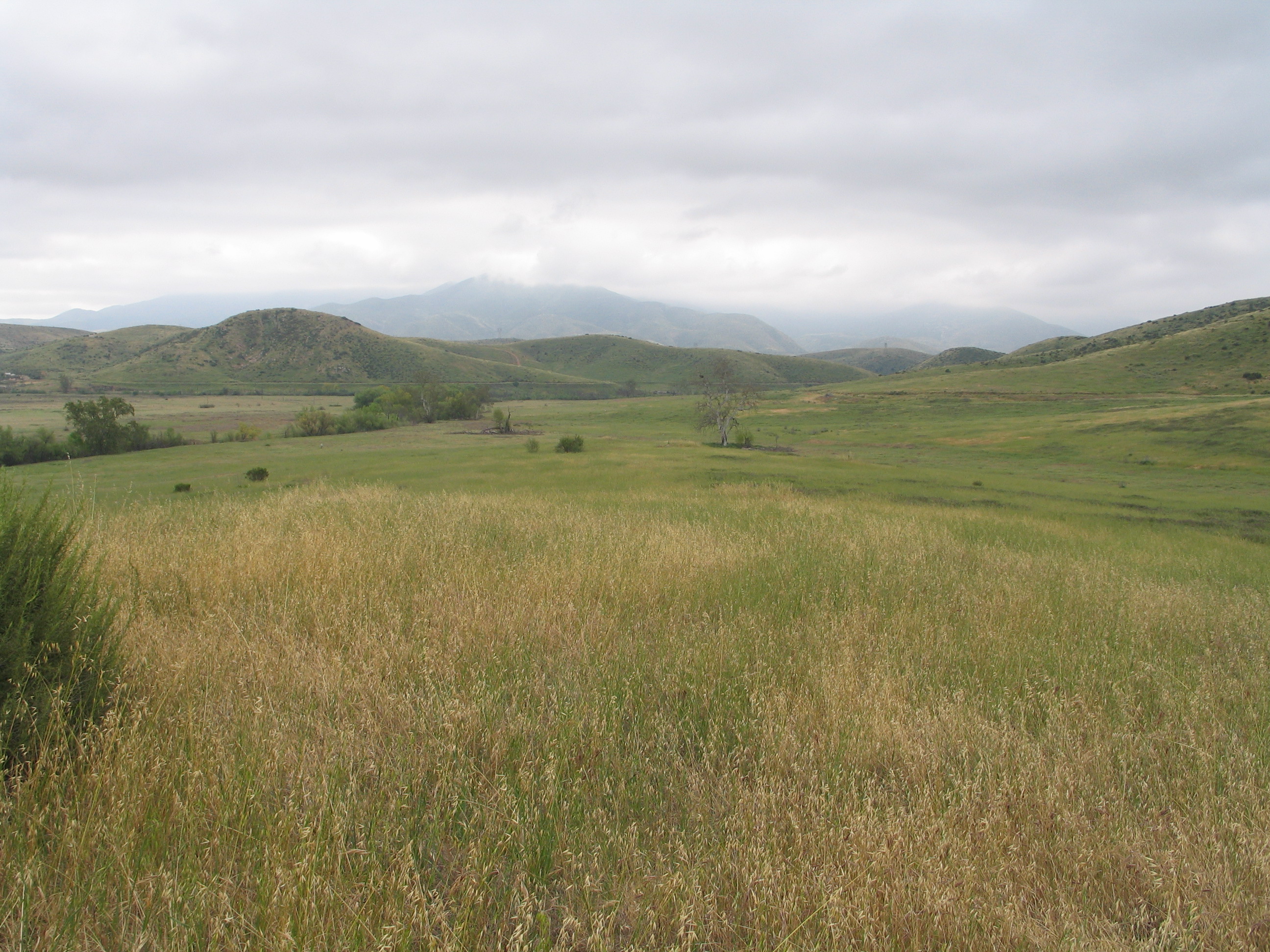
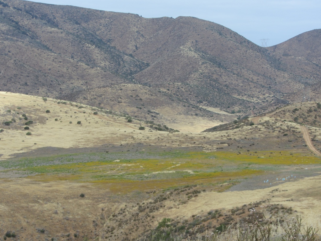
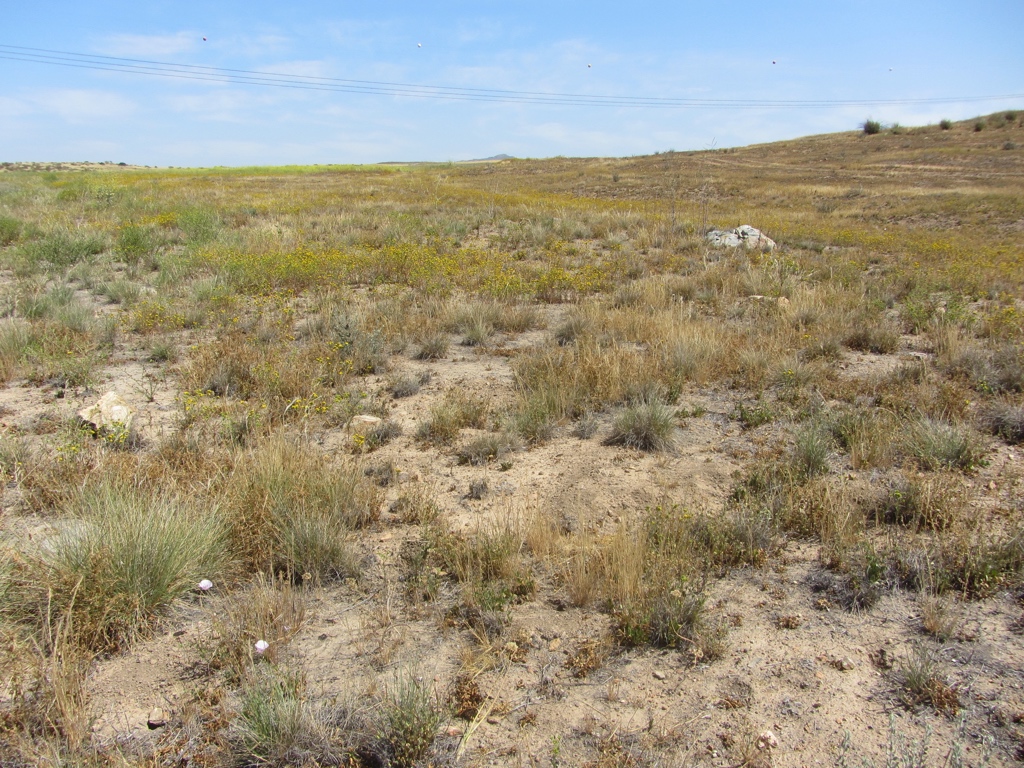
Nonnative grasslands, or annual grasslands, have sparse to dense cover of annual grasses [1]. They are associated with numerous species of showy-flowered, native annual forbs ("wildflowers"), especially in favorable rainfall years. In San Diego County the presence of nonnative Avena, Bromus, Erodium, and Brassica are common indicators. Depending on past disturbance and annual rainfall, annual forbs may be the dominant species in some areas; however, it is presumed that nonnative grasses will soon dominate.

Alliances

The grassland vegetation community includes 2 native grassland alliances and 5 nonnative semi-natural stands of nonnative grasses and forbs in the western portion of the MSPA that are mapped to the alliance level [3]. The Nasella pulchra alliance is mapped on over 1,200 acres and is dominated by this native bunchgrass or it is present with other native perennial grasses and forbs [4]. The Leymus triticoides alliance is dominated by this native grass species or codominant with other native and nonnative grasses and forbs. It is mapped on only one acre in the area of the MSPA mapped to alliance level [1]. Most grassland is classified as Mediterranean California naturalized annual and perennial semi-natural grassland in which nonnative grasses and forbs are dominant over native species [2].

Range wide dist. status

Valley needlegrass grassland was formerly extensive around the Sacramento, San Joaquin, and Salinas Valleys, as well as the Los Angeles Basin, but is now much reduced [1]. Valley sacaton grassland was formerly extensive in the Tulare Lake Basin and along the San Joaquin Valley trough north to Stanislaus and Contra Costa Counties, but is now much reduced. Nonnative and annual grasslands are found in the valleys and foothills of most of California except for the north coastal and desert regions. Usually found below 3000 ft, but can reach 4000 ft in the Tehachapi Mountains and interior San Diego County. Formerly occupied large portions of the Sacramento, San Joaquin, and Salinas Valleys as well as the Los Angeles Basin, areas that are now agricultural or urban.

MSPA distribution

Grassland is the third most abundant and widespread vegetation community in the MSPA with 135,749 acres in all MUs, 47,731 acres (35%) of which are conserved [2]. Grasslands in order of abundance are most prevalent in MUs 9, 10, 3, 5, and 6. Valley needlegrass grassland occurs in Alpine (Wright’s Field), Ramona, Olivenhain, San Marcos, Camp Pendleton, Rincon, Mesa Grande, Eagle Peak Road, and Otay Mesa [1]. Valley sacaton grassland occurs in Ramona, Cottonwood Valley, Jacumba, and San Marcos. Saltgrass grasslands occur in Ramona, Lake Hodges, and other areas throughout the county. Nonnative and annual grasslands can be found throughout the County, but notable areas include: Otay Mesa, Barona, parts of Henshaw Valley, Borrego Springs, Love Valley, Santa Maria Valley, and Rancho Guejito. There are 29 MSP species that use grassland habitats; some are closely associated only with native grasslands, while others are affiliated with nonnative grasslands [2].

Habitat affinities

Valley needlegrass grassland usually occur on fine-textured (often clay) soils that are moist or waterlogged during winter, but very dry in summer [1]. In San Diego County valley needlegrass grassland becomes montane perennial grassland above approximately 2,000 feet. Valley sacaton grasslands occur on fine textured, poorly drained, usually alkaline soils. Most sites have seasonally high water tables or are overflowed during winter flooding. Saltgrass stands form in inland alkaline settings such as around playa edges and springs in the desert, as well as upper coastal salt marshes [4]. Saltgrass grasslands occur on fine textured, usually alkaline soils that are poorly drained [1]. Intergrades and often co-occurs with alkali meadow and various riparian habitats. Nonnative and annual grasslands occur on fine-textured, often clay soils, moist or even waterlogged during the winter rainy season and very dry during the summer and fall. Oak woodland is often adjacent on moister, better drained soils.

Ecosystem processes

For nonnative and annual grasslands, germination occurs with the onset of the late fall rains [1]. Growth, flowering, and seed-set occur from winter through spring. With a few exceptions, the plants are dead through the summer-fall dry season, persisting as seeds.

Threats

A primary threat to native grassland is loss, fragmentation, and degradation due to urban and agricultural development [2]. In areas altered by high fire frequency, deep tilling of soils, and/or intensive grazing, nonnative bromes and “false” bromes may become abundant and dominate the vegetation [1]. Invasive nonnative grasses and forbs are the largest threat to remaining native grasslands [3]. Nonnative grasses can prevent native ephemerals from sprouting through competitive interactions. Desert vegetation invaded by Bromus rubens and Schismus spp. may convert to semi-natural grasslands with frequent fire [4].

Special considerations

Nonnative grasslands that provide foraging and burrowing habitat for MSP species can become degraded by tall, dense grasses that dry out and create a thick layer of thatch that becomes unsuitable for ground squirrels [5]. This can decrease suitability of nonnative grasslands for those species that depend on ground squirrels and rabbits for prey. Grasslands in the MSPA are managed for different purposes [2]. Native grasslands are managed to increase native grass and forb cover and diversity, while large, expansive nonnative grasslands are managed to provide the optimal structure to support habitat for MSP species. For example, golden eagle and badger need large, undisturbed grasslands with low grass cover that supports prey species, such as rabbits and California ground squirrels. Western burrowing owls also need similar grasslands with ground squirrels that serve as ecosystem engineers and provide burrows [6]. Shrublands heavily invaded with nonnative grasses are also managed to reduce cover of these species to promote native grasses, forbs, and shrubs and avoid vegetation type conversion to nonnative grassland.

Sources

[1] Oberbauer, T. A., M. Kelly, and Jeremy Buegge. 2008. Draft Vegetation Communitties of San Diego County. Based on “Preliminary Descriptions of the Terrestrial Natural Communities of California”, Robert F. Holland, Ph.D., October 1986. San Diego, CA.

[2] San Diego Management and Monitoring Program and The Nature Conservancy. 2017. Management and Monitoring Strategic Plan for Conserved Lands in Western San Diego County: A Strategic Habitat Conservation Roadmap. 3 Volumes. Prepared for the San Diego Association of Governments. San Diego.

[3] SANDAG. 2012. ECO_VEGETATION_WSD_2012. Principal authors: (AECOM) Oberbauer, T., F. Sproul, J. Dunn, and L. Woolley. www.sangis.org. Accessed September 2016.

[4] Sproul, F. et al. 2011. Vegetation Classification Manual for Western San Diego County. First. San Diego, CA.

[5] Wisinski, C., J. P. Montagne, S. Marczak, D. M. Shier, L. A. Nordstrom, and R. R. Swaisgood. 2015. Project Report: An Adaptive Management Approach to Recovering Burrowing Owl Populations and Restoring a Grassland Ecosystem in San Diego County. San Diego Zoo Global Institute for Conservation Research, Escondido, CA.

[6] San Diego Zoo Institute for Conservation Research. 2016. Burrowing Owl Conservation and Management Plan for San Diego County. San Diego, CA. 39 pp.